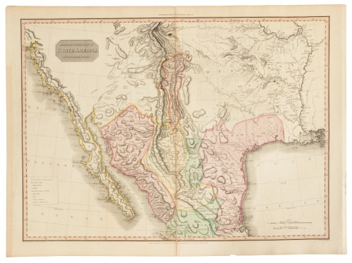
North America. Pinkerton (John), Spanish Dominions in North America, Northern Part, Cadell & Davies & Longman, Hurst, Rees, Orme & Brown, 1811, double-page engraved map with contemporary wash colouring, 515 x 705 mm, together with Discoveries of Capts. Ross Parry & Franklin in the Arctic Regions, circa 1842, unattributed engraved map with contemporary outline colouring, some offsetting, 305 x 445 mm (Quantity: 2) A map of Spanish territorial holdings in North America by the Scottish cartographer and antiquarian John Pinkerton (1758-1826). Regions depicted include California and much of the southwestern United States, as well as French-occupied Louisiana and the northern portion of modern Mexico. The map details major topographical features and the locations of various Native American peoples, farms, mines, and military garrisons. Published as part of Pinkerton's Modern Atlas.
North America. Pinkerton (John), Spanish Dominions in North America, Northern Part, Cadell & Davies & Longman, Hurst, Rees, Orme & Brown, 1811, double-page engraved map with contemporary wash colouring, 515 x 705 mm, together with Discoveries of Capts. Ross Parry & Franklin in the Arctic Regions, circa 1842, unattributed engraved map with contemporary outline colouring, some offsetting, 305 x 445 mm (Quantity: 2) A map of Spanish territorial holdings in North America by the Scottish cartographer and antiquarian John Pinkerton (1758-1826). Regions depicted include California and much of the southwestern United States, as well as French-occupied Louisiana and the northern portion of modern Mexico. The map details major topographical features and the locations of various Native American peoples, farms, mines, and military garrisons. Published as part of Pinkerton's Modern Atlas.


Try LotSearch and its premium features for 7 days - without any costs!
Be notified automatically about new items in upcoming auctions.
Create an alert