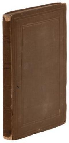
Title: Central Route to the Pacific, from the Valley of the Mississippi to California: Journal of the Expedition of E.F. Beale, Superintendent of Indian Affairs in California, and Gwinn Harris Heap, from Missouri to California, in 1853 Author: Heap, Gwinn Harris Place: Philadelphia Publisher: Lippincott, Grambo Date: 1854 Description: 136 + 32 ad pp. Illustrated with 13 lithograph plates, a few color; folding lithographed map tipped to rear pastedown, as issued. (8vo) 22.7x14 cm (9x5½"), original blindstampd cloth, spine lettered in gilt. First Edition. Well-illustrated first-hand relation of Western travel. "Heap's letters were printed in the National Intelligencer (Washington, D.C.) November 26, 29, December 1, 3, 6, 8 and 13, 1853, and comprise the entire text of this book... They were probably submitted by Senator Benton..." - W.C. Graff notes that "Some of the areas explored are here described for the first time." This copy complete the map, which Howes says was "not inserted in all copies" and is most often lacking. The "Map of the Central Route from the Valley of the Mississippi to California. Compiled & drawn by G.H. Heap," has beneath the title, a printed "Note. The Route from the mouth of Huerfano R. to Las Vegas de Santa Clara is from notes kept by G.H Heap during the Expedition... The remainder is from surveys of J.C. Frémont and others.' The map measures 18.7x88 cm. (7¼x34½"). Wheat notes that the map "extends from Van Buren (Fort Smith) and Independence on the east, and the Pacific Ocean, and from an unnamed lake (Sevier) near 'Massacre of Capt. Gunnison & party,' on the Servers, or Nicollet River, and Pike's Peak, on the north, to San Bernardino Mt. and Santa Fe on the south... There are details in the Rocky Mountain Area." Copies with the map are quite scarce. Bookplate of Eva Scott Fényes de Csokaly. Provenance: R. Hawley, 4/91 References: Cowan p.273; Graff 1837; Howes H378; Sabin 31175; Wagner-Camp 235; Wheat Transmississippi 808. Lot Amendments Condition: Fading and some staining to binding, spine ends worn, corners less so, remains of old paper spine label; rear flyleaf torn out, with tear to last ad leaf; top left corner of plate 3 torn off not affecting image; overall very good, very uncommon with the map. Item number: 265216
Title: Central Route to the Pacific, from the Valley of the Mississippi to California: Journal of the Expedition of E.F. Beale, Superintendent of Indian Affairs in California, and Gwinn Harris Heap, from Missouri to California, in 1853 Author: Heap, Gwinn Harris Place: Philadelphia Publisher: Lippincott, Grambo Date: 1854 Description: 136 + 32 ad pp. Illustrated with 13 lithograph plates, a few color; folding lithographed map tipped to rear pastedown, as issued. (8vo) 22.7x14 cm (9x5½"), original blindstampd cloth, spine lettered in gilt. First Edition. Well-illustrated first-hand relation of Western travel. "Heap's letters were printed in the National Intelligencer (Washington, D.C.) November 26, 29, December 1, 3, 6, 8 and 13, 1853, and comprise the entire text of this book... They were probably submitted by Senator Benton..." - W.C. Graff notes that "Some of the areas explored are here described for the first time." This copy complete the map, which Howes says was "not inserted in all copies" and is most often lacking. The "Map of the Central Route from the Valley of the Mississippi to California. Compiled & drawn by G.H. Heap," has beneath the title, a printed "Note. The Route from the mouth of Huerfano R. to Las Vegas de Santa Clara is from notes kept by G.H Heap during the Expedition... The remainder is from surveys of J.C. Frémont and others.' The map measures 18.7x88 cm. (7¼x34½"). Wheat notes that the map "extends from Van Buren (Fort Smith) and Independence on the east, and the Pacific Ocean, and from an unnamed lake (Sevier) near 'Massacre of Capt. Gunnison & party,' on the Servers, or Nicollet River, and Pike's Peak, on the north, to San Bernardino Mt. and Santa Fe on the south... There are details in the Rocky Mountain Area." Copies with the map are quite scarce. Bookplate of Eva Scott Fényes de Csokaly. Provenance: R. Hawley, 4/91 References: Cowan p.273; Graff 1837; Howes H378; Sabin 31175; Wagner-Camp 235; Wheat Transmississippi 808. Lot Amendments Condition: Fading and some staining to binding, spine ends worn, corners less so, remains of old paper spine label; rear flyleaf torn out, with tear to last ad leaf; top left corner of plate 3 torn off not affecting image; overall very good, very uncommon with the map. Item number: 265216
.jpg)


Try LotSearch and its premium features for 7 days - without any costs!
Be notified automatically about new items in upcoming auctions.
Create an alert