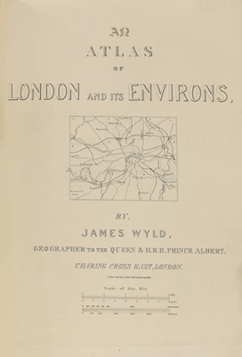
Wyld (James). Maps & Plans, Showing the Principal Movements, Battles & Sieges, in which the British Army was engaged during the War from 1808 to 1814 in the Spanish Peninsula and the South of France, [1840], engraved title and dedication, contents page printed in blue, 39 lithographed maps and plans, (7 double-page, 4 with fold-out extensions, 4 with movable flaps), many with hand-coloured troop positions and some geographical features, some light spotting throughout, some mostly short marginal tear repairs to versos without loss, ink presentation inscription to title, 'Presented to D. Captain Adjutant General for Instruction, South Eastern District, by Col. C[harles] J[ohn] Cramer Roberts [1834-1895], late 9th (Norfolk) Regiment, Feb. 1895', original red half morocco, gilt red morocco label to upper cover, heavily rubbed and slightly soiled, atlas folio (85 x 69 cm), together with: Memoir Annexed to an Atlas Containing Plans..., London: James Wyld, 1841, index/errata leaf and publisher's advert leaf at rear, occasional spotting, all edges gilt, contemporary half morocco, slightly rubbed, 4to (30.5 x 23.5 cm) (Quantity: 2) First and only edition of this colossal and uncommon atlas, the maps being the meticulous work of the surveyor Thomas Livingston Mitchell (1792-1855). The Memoir was issued to accompany the atlas, and due to size incompatibility and different publishing dates it is scarce to find both volumes together.
Wyld (James). Maps & Plans, Showing the Principal Movements, Battles & Sieges, in which the British Army was engaged during the War from 1808 to 1814 in the Spanish Peninsula and the South of France, [1840], engraved title and dedication, contents page printed in blue, 39 lithographed maps and plans, (7 double-page, 4 with fold-out extensions, 4 with movable flaps), many with hand-coloured troop positions and some geographical features, some light spotting throughout, some mostly short marginal tear repairs to versos without loss, ink presentation inscription to title, 'Presented to D. Captain Adjutant General for Instruction, South Eastern District, by Col. C[harles] J[ohn] Cramer Roberts [1834-1895], late 9th (Norfolk) Regiment, Feb. 1895', original red half morocco, gilt red morocco label to upper cover, heavily rubbed and slightly soiled, atlas folio (85 x 69 cm), together with: Memoir Annexed to an Atlas Containing Plans..., London: James Wyld, 1841, index/errata leaf and publisher's advert leaf at rear, occasional spotting, all edges gilt, contemporary half morocco, slightly rubbed, 4to (30.5 x 23.5 cm) (Quantity: 2) First and only edition of this colossal and uncommon atlas, the maps being the meticulous work of the surveyor Thomas Livingston Mitchell (1792-1855). The Memoir was issued to accompany the atlas, and due to size incompatibility and different publishing dates it is scarce to find both volumes together.


Testen Sie LotSearch und seine Premium-Features 7 Tage - ohne Kosten!
Lassen Sie sich automatisch über neue Objekte in kommenden Auktionen benachrichtigen.
Suchauftrag anlegen