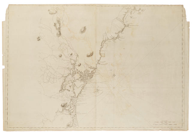
Untitled map of the environs of Philadelphia.
London: 1777. 2-sheet engraved map, hand-colored in outline (770 x 1055 mm). Condition : dampstaining extending from the left, trimmed close, fold reinforced on verso, some minor losses and tears at edges and at lower fold crudely repaired, minor toning overall. Provenance : Martin P. Snyder. The legendary cartographer Des Barres spent several years in North America in advance of the Revolution charting the Atlantic coast. His publication of the famed atlas The Atlantic Neptune provided essential information to the British Navy at the time of the war. This map, however, is a bit of a curiosity, as it was not based on his own surveys or that of British naval officers, but on Thomas Holme’s map of the eastern portion of Pennsylvania published a century earlier. However, “[Holme’s map] was updated [by Des Barres] particularly to show the road system developed around Philadelphia over the intervening ninety years” (Snyder). Perhaps the “historical” map was intended by Des Barres, at the height of the Revolution, to remind his public of the colonial origins of the province by harkening back to Penn’s original grant. Snyder, COI 269 (this copy illustrated as Fig. 187).


.jpg)
.jpg)


.jpg)

Testen Sie LotSearch und seine Premium-Features 7 Tage - ohne Kosten!
Lassen Sie sich automatisch über neue Objekte in kommenden Auktionen benachrichtigen.
Suchauftrag anlegen