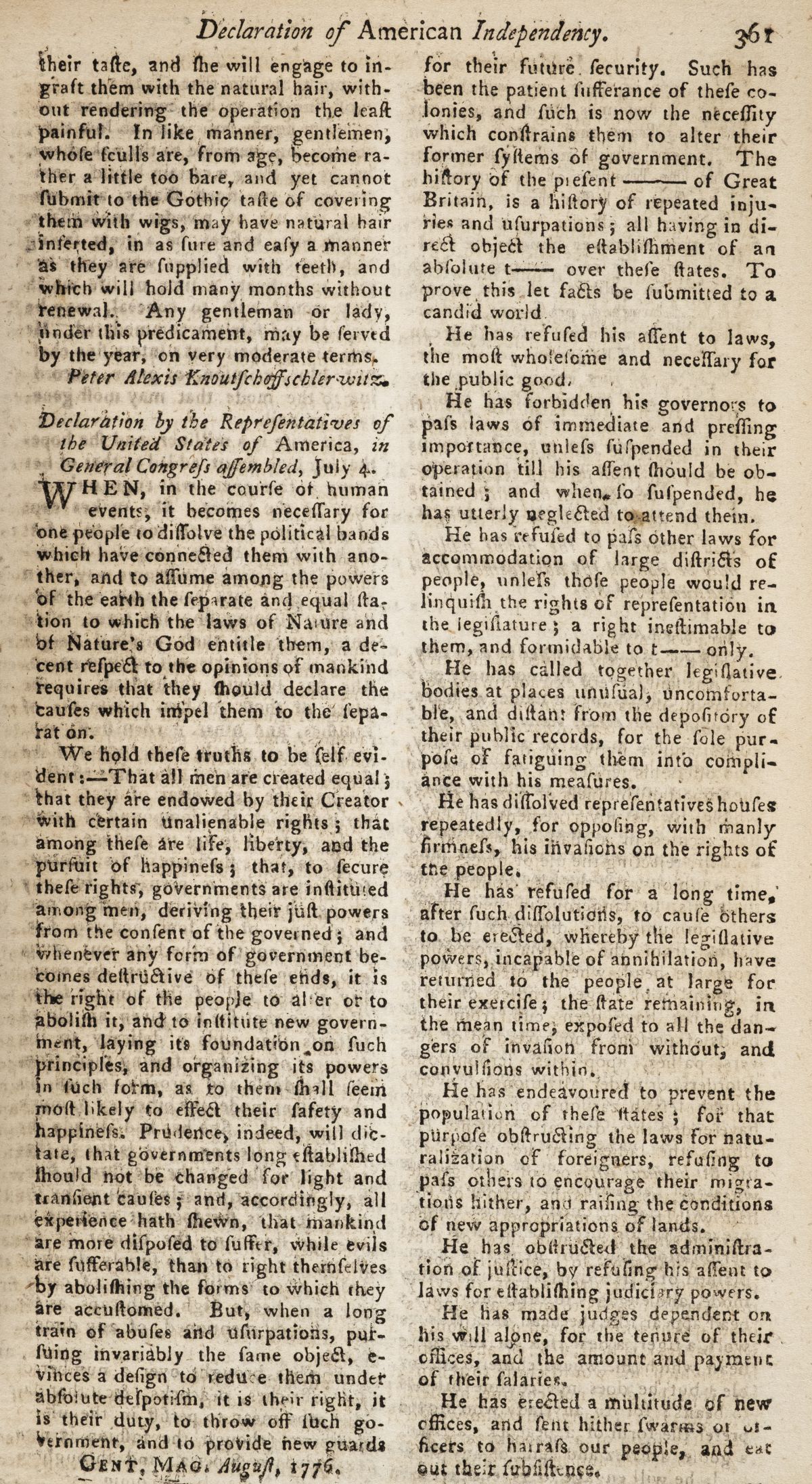
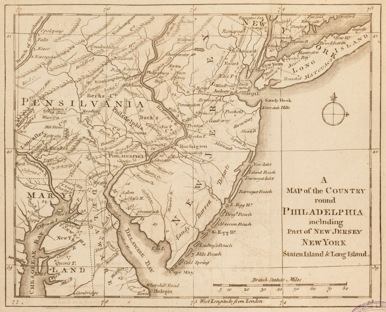
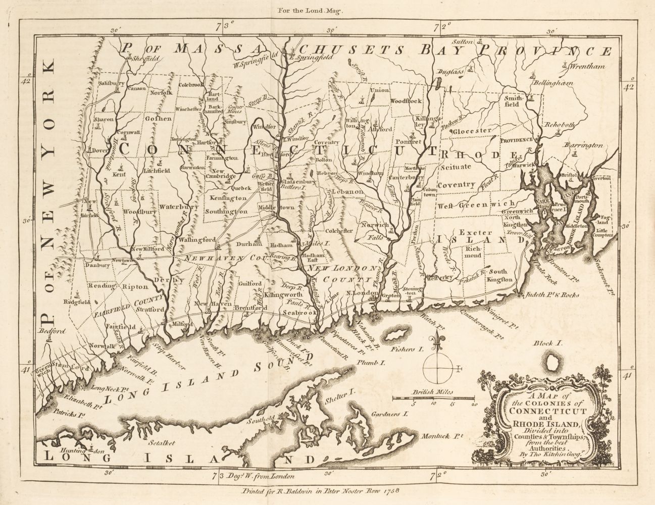
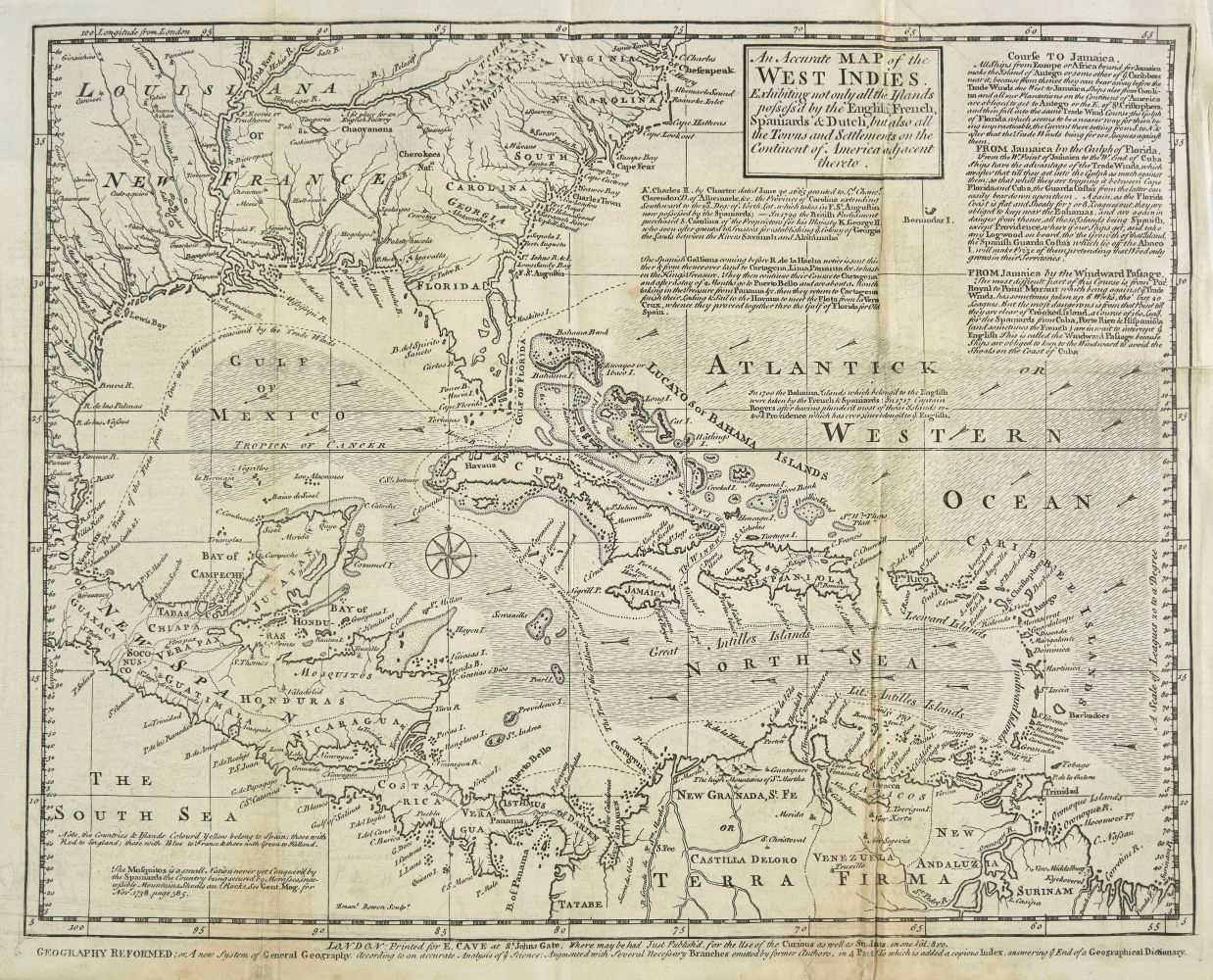
The Gentleman's Magazine, or Monthly Intelligencer, 158 volumes, a near unbroken run, volumes I-XLVIII, L-LXX, LXXII-LXXX, LXXXIII-LXXXVIII, CX-CIII, New Series, volumes I-III, V, VII-VIII, X, XVI, XXIII, XXV & XXXV-XXXVII, London: 1731-1852, lacking only volumes XLIX (1779), LXXI (1801), LXXXI-LXXXII (1811 & 1812), LXXXIX (July-December 1819), and New Series, volumes IV, VI, and IX (July-December 1835, July-December 1836, and January-June 1838), profusely illustrated with engraved plates and maps, including many folding, woodcut illustrations to text, almost all bound in contemporary half calf, the first twelve volumes rebound in good-quality antique-style modern uniform lighter brown half calf, spines gilt with morocco labels, occasional wear and a few covers detached (bindings generally in better than usual condition), one or two with later rebacks or repairs, together with four volumes only of The Gentleman's Magazine Library: being a classified collection of the chief contents of the Gentleman's Magazine from 1731 to 1868, edited by George Lawrence Gomme, English Topography, Parts IV, VI, X and XII only, 1893-1900, bound in original cloth, all 8vo (Quantity: 158) Provenance: Many of the earlier volumes bear the early 19th-century bookplate of Toft Hall, Cheshire, the seat of Ralf Leycester (1763-1835), MP for Shaftesbury (1821-1830). The house contained a library which was added during the renovations made between 1810 and 1813 by the architect Samuel Pepys Cockerell Several other volumes contain 19th-century bookplates from different owners. A near-complete run of the Gentleman's Magazine from its commencement in 1731 to the early 19th century, complete with the majority of the required maps and plates. Sold as a periodical, not subject to return. This impressive run contains many of the important maps and plans relating to the American Wars of Independence, and also includes one of the earliest reports of the Boston Tea Party (volume 44, 1774), and one of the earliest British printings of the Declaration of American Independence (volume 46, 1776). Engraved American maps present in this lot, as listed in David Jolly, Maps of America in Periodicals before 1800 are, according to his numbered listing: 3-10, 17, 26, 32-33, 36, 44, 45 (some fraying to left and right margins with slight loss to lower right edge), 46 (bound opposite page 123), 53-55, 65 (central horizontal closed tear without loss), 69-70, 82, 83 (slight offsetting), 118-122, 164-165, 186-190, 219-222, 242, 244 (bound facing page 513), 245, 247-248, 257, 258 (bound opposite page 264), 259-260, 286 (slight offsetting), 287, 290 (slight offsetting), 309, 319-321, 336, 357 (short closed tear at head), 409, and 427. Amongst these are: An Accurate Map of the West Indies (no. 3, 1740), New Map or Chart of the Western or Atlantic Ocean (no. 10, 1740), Plan of the Harbour of Chebucto and Town of Halifax (no. 36, 1750), Map of Philadelphia and Parts Adjacent (no. 45, 1753, with slight loss), Map of the British and French Settlements in North America (no. 54, 1755), Map of that Part of America which was the Principal Seat of War in 1756 (no. 69, 1757), Accurate Map of the British Empire in Nth. America as settled by the Preliminaries in 1762 (no. 190, 1762), Louisiana, Virginia, & Carolina (no. 220, 1763), Map of the New Governments of East & West Florida (no. 221, 1763), The British Governments in Nth. America laid down Agreeable to the Proclamation of Octr. 7, 1763 (no. 222, 1763), Map of Part of West Florida, from Pensacola to the Mouth of the Iberville River (no. 247, 1772), Plan of the Town and Chart of the Harbour of Boston (no. 257, 1775), Map of 100 Miles round Boston (no. 258, 1775), New and Correct Plan of the Town of Boston (no. 260, 1775), Map of Connecticut and Rhode Island (no. 290, 1776), Map of Philadelphia and Parts Adjacent (no. 309, 1777), Map of Hudson's River (no. 319, 1778), Map of the Island of Dominica (no. 320, 1778), Map of the Island of Tobago
The Gentleman's Magazine, or Monthly Intelligencer, 158 volumes, a near unbroken run, volumes I-XLVIII, L-LXX, LXXII-LXXX, LXXXIII-LXXXVIII, CX-CIII, New Series, volumes I-III, V, VII-VIII, X, XVI, XXIII, XXV & XXXV-XXXVII, London: 1731-1852, lacking only volumes XLIX (1779), LXXI (1801), LXXXI-LXXXII (1811 & 1812), LXXXIX (July-December 1819), and New Series, volumes IV, VI, and IX (July-December 1835, July-December 1836, and January-June 1838), profusely illustrated with engraved plates and maps, including many folding, woodcut illustrations to text, almost all bound in contemporary half calf, the first twelve volumes rebound in good-quality antique-style modern uniform lighter brown half calf, spines gilt with morocco labels, occasional wear and a few covers detached (bindings generally in better than usual condition), one or two with later rebacks or repairs, together with four volumes only of The Gentleman's Magazine Library: being a classified collection of the chief contents of the Gentleman's Magazine from 1731 to 1868, edited by George Lawrence Gomme, English Topography, Parts IV, VI, X and XII only, 1893-1900, bound in original cloth, all 8vo (Quantity: 158) Provenance: Many of the earlier volumes bear the early 19th-century bookplate of Toft Hall, Cheshire, the seat of Ralf Leycester (1763-1835), MP for Shaftesbury (1821-1830). The house contained a library which was added during the renovations made between 1810 and 1813 by the architect Samuel Pepys Cockerell Several other volumes contain 19th-century bookplates from different owners. A near-complete run of the Gentleman's Magazine from its commencement in 1731 to the early 19th century, complete with the majority of the required maps and plates. Sold as a periodical, not subject to return. This impressive run contains many of the important maps and plans relating to the American Wars of Independence, and also includes one of the earliest reports of the Boston Tea Party (volume 44, 1774), and one of the earliest British printings of the Declaration of American Independence (volume 46, 1776). Engraved American maps present in this lot, as listed in David Jolly, Maps of America in Periodicals before 1800 are, according to his numbered listing: 3-10, 17, 26, 32-33, 36, 44, 45 (some fraying to left and right margins with slight loss to lower right edge), 46 (bound opposite page 123), 53-55, 65 (central horizontal closed tear without loss), 69-70, 82, 83 (slight offsetting), 118-122, 164-165, 186-190, 219-222, 242, 244 (bound facing page 513), 245, 247-248, 257, 258 (bound opposite page 264), 259-260, 286 (slight offsetting), 287, 290 (slight offsetting), 309, 319-321, 336, 357 (short closed tear at head), 409, and 427. Amongst these are: An Accurate Map of the West Indies (no. 3, 1740), New Map or Chart of the Western or Atlantic Ocean (no. 10, 1740), Plan of the Harbour of Chebucto and Town of Halifax (no. 36, 1750), Map of Philadelphia and Parts Adjacent (no. 45, 1753, with slight loss), Map of the British and French Settlements in North America (no. 54, 1755), Map of that Part of America which was the Principal Seat of War in 1756 (no. 69, 1757), Accurate Map of the British Empire in Nth. America as settled by the Preliminaries in 1762 (no. 190, 1762), Louisiana, Virginia, & Carolina (no. 220, 1763), Map of the New Governments of East & West Florida (no. 221, 1763), The British Governments in Nth. America laid down Agreeable to the Proclamation of Octr. 7, 1763 (no. 222, 1763), Map of Part of West Florida, from Pensacola to the Mouth of the Iberville River (no. 247, 1772), Plan of the Town and Chart of the Harbour of Boston (no. 257, 1775), Map of 100 Miles round Boston (no. 258, 1775), New and Correct Plan of the Town of Boston (no. 260, 1775), Map of Connecticut and Rhode Island (no. 290, 1776), Map of Philadelphia and Parts Adjacent (no. 309, 1777), Map of Hudson's River (no. 319, 1778), Map of the Island of Dominica (no. 320, 1778), Map of the Island of Tobago







Testen Sie LotSearch und seine Premium-Features 7 Tage - ohne Kosten!
Lassen Sie sich automatisch über neue Objekte in kommenden Auktionen benachrichtigen.
Suchauftrag anlegen