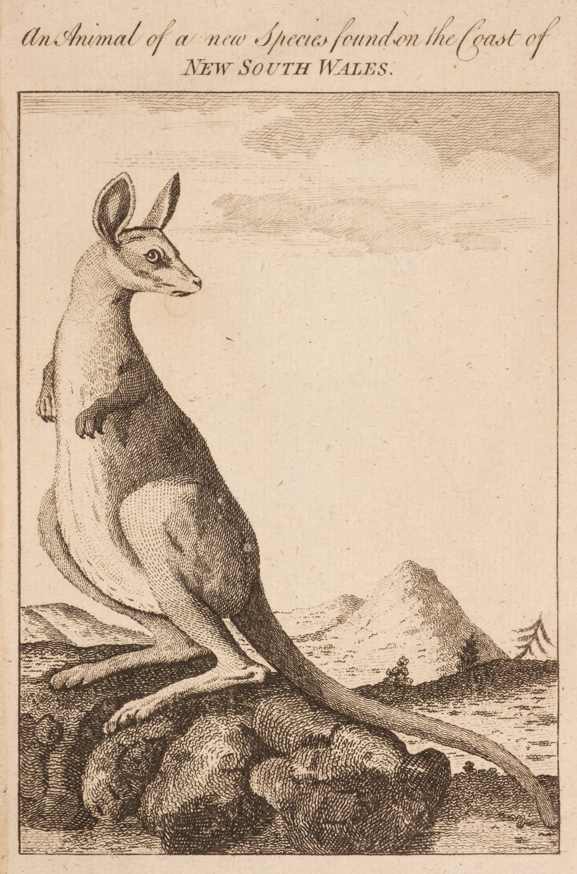
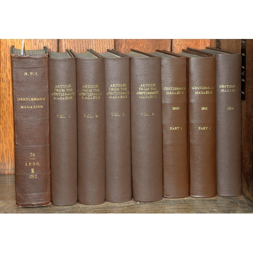
The Gentleman's Magazine, or Monthly Intelligencer, 118 volumes, 1731-1747, 1749-1771, 1774-1785, 1787-1793, 1795-1800 part 1, 1801 part 2, 1814 part 2, 1815, 1816 part 2, 1817-1818, 1820 part 2- 1830, 1831 part 2 - 1833, illustrated with numerous engraved plates and maps (some folding), woodcut illustrations to text, many text blocks broken and some leaves detached, contemporary and later half calf, some with boards detached (few lacking), some spines split and broken, very worn, 8vo, together with Gomme (George Laurence, editor). The Gentleman's Magazine Library: being a classified collection of the chief contents of the Gentleman's Magazine from 1731 to 1868, London: Elliot Stock, 1884, library ink stamps to verso of half-title and verso of title page, modern black library buckram, classification number at foot of spine, 8vo (Quantity: 119) Sold as a periodical, not subject to return. Volume 44 for the year 1774 contains one of the earliest reports of the Boston Tea Party. Volume 46 for the year 1776 includes one of the earliest British publications of the Declaration of American Independence. The volumes included in this lot contain several engraved maps relating to America, and also some related woodcut maps and plans within the text. The engraved American maps present in the lot are listed in Maps of America in Periodicals before 1800 by David Jolly and comprise numbers 3, 7, 9-10, 23, 32, 36, 44-47 (repaired closed tear to no. 45), 54, 56, 65, 82, 119-122, 164-165, 186-190, 219-222, 242, 244-245, 257-258, 260, 286-287, 290, 309, 319-321, 328-329, 336, 357 and 427 (small hole to no. 427). Some of the maps of interest present include A Map of the British American Plantations, Extending from Boston in New England to Georgia (no. 47, 1754), A Map of the British and French Settlements in North America (no. 54, 1755), A Map of the Caribbee Islands..., by Thos. Jefferys, Geographer (no. 65, 1756), A New and Accurate Map of the Isles of Guadaloupe, Marie-Galante &c. (no. 120, 1759), A Map of the Island of Oreans with the Environs of Quebec (no. 121, 1759), An Accurate Map of the West Indies, with the Adjacent Coast (no. 186, 1762), A Map of the Island of Jamaica (no. 187, 1762), Plan of the City and Harbour of Havanna (no. 188, 1762), An Accurate Map of the British Empire in Nth. America as Settled by the Preliminaries in 1762 (no. 190, 1762), A Map of the New Governments, of East & West Florida (no. 221, 1763), The British Governments in Nth. America Laid Down Agreeable to the Proclamation of Octr. 7. 1763 (no. 222, 1763), A Plan of Bridge Town, in the Island of Barbadoes (no. 242, 1766), A Map of that part of America where a Degree of Latitude was measured for the Royal Society (no. 244, 1769), A Map of Falkland Islands... (no. 245, 1770), A Plan of the Town and Chart of the Harbour of Boston Exhibiting a view of the Islands Castle Forts and Entrances into the said Harbour (no. 257, 1775), A Map of 100 Miles round Boston (no. 258, 1775), A New and Correct Plan of the Town of Boston (no. 260, 1775), A Map of Connecticut and Rhode Island, with Long Island Sound, &c. (no. 290, 1776), A Map of Philadelphia and Parts Adjacent (no. 309, 1777), Map of Hudson's River, with the Adjacent Country (no. 319, 1778), A Map of the Island of Dominica, taken from an Actual Survey... (no. 320, 1778), A Map of the Island of Tobago, Drawn from an Actual Survey (no. 321, 1778), Plan of St. Lucia, in the West Indies: Shewing the Positions of the English & French Forces with the Attacks made at its Reduction in Decr. 1778 (no. 328, 1779).
The Gentleman's Magazine, or Monthly Intelligencer, 118 volumes, 1731-1747, 1749-1771, 1774-1785, 1787-1793, 1795-1800 part 1, 1801 part 2, 1814 part 2, 1815, 1816 part 2, 1817-1818, 1820 part 2- 1830, 1831 part 2 - 1833, illustrated with numerous engraved plates and maps (some folding), woodcut illustrations to text, many text blocks broken and some leaves detached, contemporary and later half calf, some with boards detached (few lacking), some spines split and broken, very worn, 8vo, together with Gomme (George Laurence, editor). The Gentleman's Magazine Library: being a classified collection of the chief contents of the Gentleman's Magazine from 1731 to 1868, London: Elliot Stock, 1884, library ink stamps to verso of half-title and verso of title page, modern black library buckram, classification number at foot of spine, 8vo (Quantity: 119) Sold as a periodical, not subject to return. Volume 44 for the year 1774 contains one of the earliest reports of the Boston Tea Party. Volume 46 for the year 1776 includes one of the earliest British publications of the Declaration of American Independence. The volumes included in this lot contain several engraved maps relating to America, and also some related woodcut maps and plans within the text. The engraved American maps present in the lot are listed in Maps of America in Periodicals before 1800 by David Jolly and comprise numbers 3, 7, 9-10, 23, 32, 36, 44-47 (repaired closed tear to no. 45), 54, 56, 65, 82, 119-122, 164-165, 186-190, 219-222, 242, 244-245, 257-258, 260, 286-287, 290, 309, 319-321, 328-329, 336, 357 and 427 (small hole to no. 427). Some of the maps of interest present include A Map of the British American Plantations, Extending from Boston in New England to Georgia (no. 47, 1754), A Map of the British and French Settlements in North America (no. 54, 1755), A Map of the Caribbee Islands..., by Thos. Jefferys, Geographer (no. 65, 1756), A New and Accurate Map of the Isles of Guadaloupe, Marie-Galante &c. (no. 120, 1759), A Map of the Island of Oreans with the Environs of Quebec (no. 121, 1759), An Accurate Map of the West Indies, with the Adjacent Coast (no. 186, 1762), A Map of the Island of Jamaica (no. 187, 1762), Plan of the City and Harbour of Havanna (no. 188, 1762), An Accurate Map of the British Empire in Nth. America as Settled by the Preliminaries in 1762 (no. 190, 1762), A Map of the New Governments, of East & West Florida (no. 221, 1763), The British Governments in Nth. America Laid Down Agreeable to the Proclamation of Octr. 7. 1763 (no. 222, 1763), A Plan of Bridge Town, in the Island of Barbadoes (no. 242, 1766), A Map of that part of America where a Degree of Latitude was measured for the Royal Society (no. 244, 1769), A Map of Falkland Islands... (no. 245, 1770), A Plan of the Town and Chart of the Harbour of Boston Exhibiting a view of the Islands Castle Forts and Entrances into the said Harbour (no. 257, 1775), A Map of 100 Miles round Boston (no. 258, 1775), A New and Correct Plan of the Town of Boston (no. 260, 1775), A Map of Connecticut and Rhode Island, with Long Island Sound, &c. (no. 290, 1776), A Map of Philadelphia and Parts Adjacent (no. 309, 1777), Map of Hudson's River, with the Adjacent Country (no. 319, 1778), A Map of the Island of Dominica, taken from an Actual Survey... (no. 320, 1778), A Map of the Island of Tobago, Drawn from an Actual Survey (no. 321, 1778), Plan of St. Lucia, in the West Indies: Shewing the Positions of the English & French Forces with the Attacks made at its Reduction in Decr. 1778 (no. 328, 1779).


Testen Sie LotSearch und seine Premium-Features 7 Tage - ohne Kosten!
Lassen Sie sich automatisch über neue Objekte in kommenden Auktionen benachrichtigen.
Suchauftrag anlegen