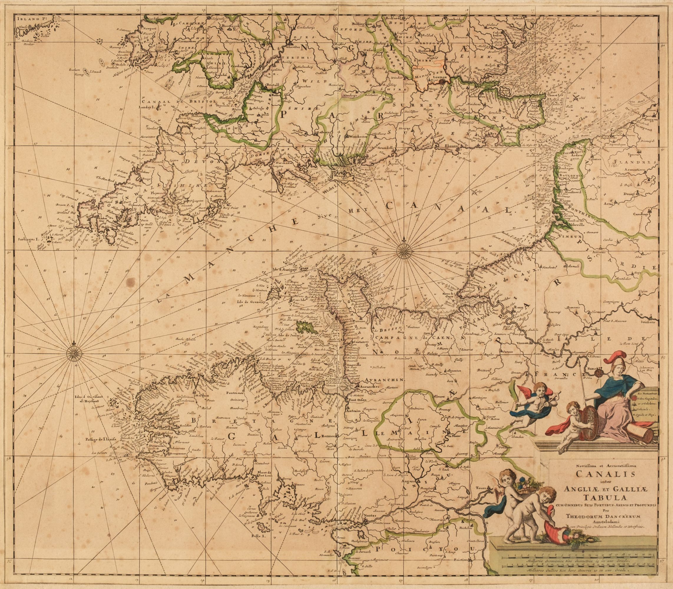
South of England. Four Sea Charts, late 17th & early 18th-century, four engraved sea charts including Danckerts (Theodore). Novissima et Accuratissima Canalis inter Angliae et Galliae Tabula..., Amsterdam: circa 1700, an engraved chart with contemporary outline colouring, trimmed to the neatline with the margins extended and strengthened on the verso, some spotting, 505 x 585 mm, together with Van Keulen (Gerald). A New Gradually Encreasing Compass Map, of a Part of the Sea Coast of England, in which is Contained the Coast of Sussex, Extending from Eastward of Hastings to Arundel Haven with their Shallownesses and Depths, 1698, uncoloured engraved sea chart, title repeated in Dutch, compass rose and numerous rhumb lines, some dust soiling and slight staining, 520 x 590 mm, with Van Keulen (Johannes). Nieuwe Kaart van Duyns en van Margat..., Amsterdam: circa 1698, uncoloured engraved sea chart, some staining and spotting, 560 x 520 mm, plus De Fer (Nicolas). L'Isle de Wight Dressée sure les Derniers Memoires..., Paris: circa 1700, hand-coloured engraved map, inset maps of Torbay and the Isles of Scilly, descriptive text in French below the image, old fold, upper left margin paired, 355 x 320 mm (Quantity: 4)
South of England. Four Sea Charts, late 17th & early 18th-century, four engraved sea charts including Danckerts (Theodore). Novissima et Accuratissima Canalis inter Angliae et Galliae Tabula..., Amsterdam: circa 1700, an engraved chart with contemporary outline colouring, trimmed to the neatline with the margins extended and strengthened on the verso, some spotting, 505 x 585 mm, together with Van Keulen (Gerald). A New Gradually Encreasing Compass Map, of a Part of the Sea Coast of England, in which is Contained the Coast of Sussex, Extending from Eastward of Hastings to Arundel Haven with their Shallownesses and Depths, 1698, uncoloured engraved sea chart, title repeated in Dutch, compass rose and numerous rhumb lines, some dust soiling and slight staining, 520 x 590 mm, with Van Keulen (Johannes). Nieuwe Kaart van Duyns en van Margat..., Amsterdam: circa 1698, uncoloured engraved sea chart, some staining and spotting, 560 x 520 mm, plus De Fer (Nicolas). L'Isle de Wight Dressée sure les Derniers Memoires..., Paris: circa 1700, hand-coloured engraved map, inset maps of Torbay and the Isles of Scilly, descriptive text in French below the image, old fold, upper left margin paired, 355 x 320 mm (Quantity: 4)


.jpg)

.jpg?w=400)




Testen Sie LotSearch und seine Premium-Features 7 Tage - ohne Kosten!
Lassen Sie sich automatisch über neue Objekte in kommenden Auktionen benachrichtigen.
Suchauftrag anlegen