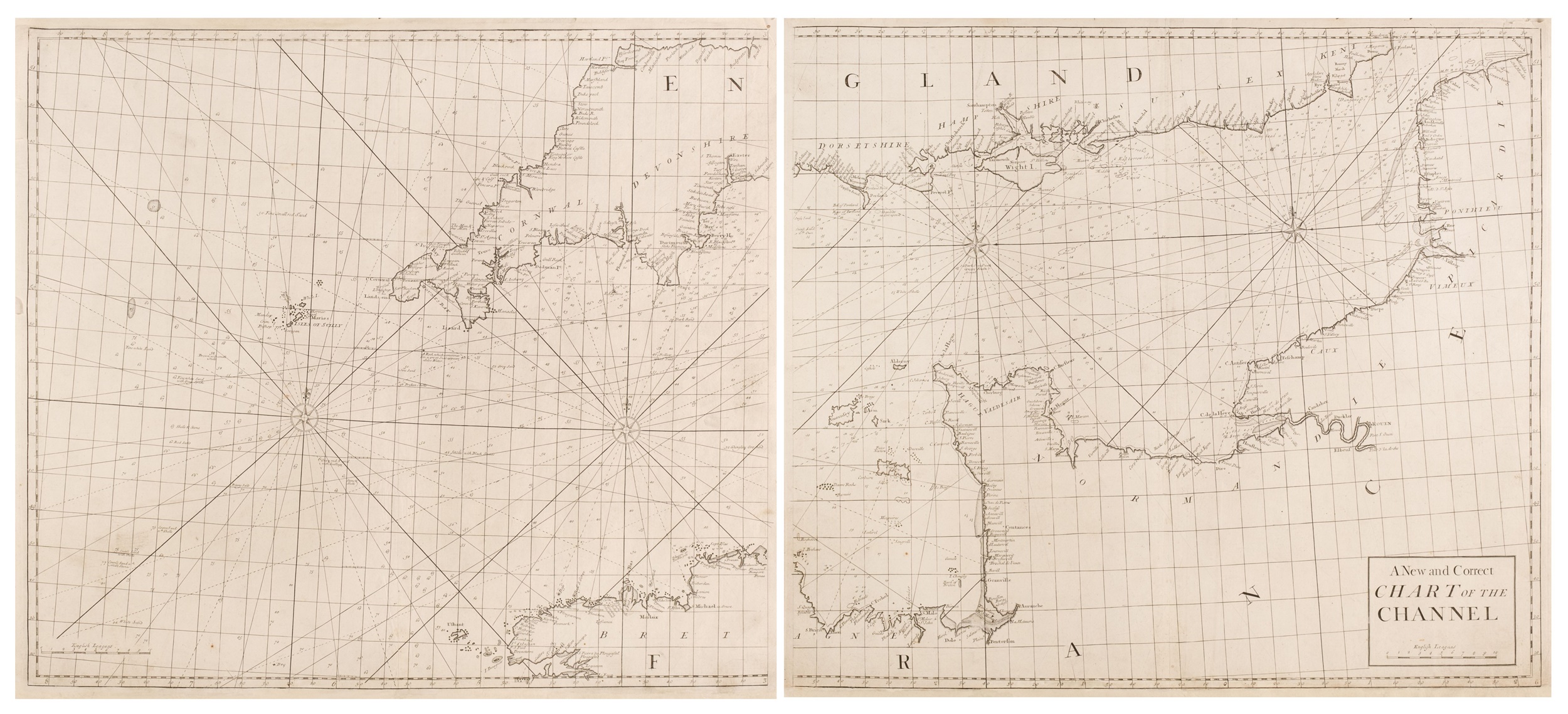
Sea Charts. The Channel. Halley (Edmond), A New and Correct Chart of the Channel, London, J. & J. Knapton, W. & J. Innys, circa 1728, uncoloured engraved sea chart on 2 sheets, some marginal tears, lower and upper margin professionally replaced with later paper, 520 x 1190 mm British Isles. Senex (John), A Globular Chart, shewing the errors of the plain and the differences of Mercators sailing and discovering the true navigation according to the Globe..., London, circa 1728, uncoloured engraved sea chart, margins professionally replaced with later paper with repaired tears into printed area, upper margin with short closed tears, 520 x 610 mm Durham. Blaeu (Willem Janszoon), De Noord-Cust van Engelandt tusschen Flamburger Hooft en de Rivier van Nicasteel, Amsterdam, 1623, uncoloured engraved sea chart, trimmed to printed area to left and right sides, 260 x 360 mm Wales. Senex (John), Milford Haven Accurately Surveyed [&] The Severn [&] Islands of Sicily, London, circa 1728, 3 uncoloured engraved sea charts on 1 sheet, some repaired short tears and chips to margins, 500 x 600 mm Newcastle. Senex (John), The River Tyne From Tinmouth to Newcastle [&] A Draught of the River Humber [&] A Draught of Yarmouth Roads [&] A Draught of Harwich [&] A Draught of Burlington Bay and Pier [&] The Road and Pier to Hartlepool, London, circa 1728, 6 uncoloured engraved sea charts on 1 sheet as published, some repaired short tears and chips to margins, 500 x 590 mm Bristol. Senex (John), A Draught of the Bristol Channel from the Holmes to King Road, including the River Avon. Taken from Capt. Holliday's Survey of the Said River ketp in ye. Merchants Hall at Bristol, London, circa 1728, uncoloured engraved sea chart, short repaired tear to lower central fold, wide margins, 470 x 560 mm Ireland. Senex (John), A Complete chart of the Coast of Ireland, London, 1728, uncoloured engraved sea chart, the 'R' in Ireland replaced in manuscript, margins professionally replaced with later paper with repaired tears into printed area, upper margin with short closed tears, 520 x 610 mm (Quantity: 7)
Sea Charts. The Channel. Halley (Edmond), A New and Correct Chart of the Channel, London, J. & J. Knapton, W. & J. Innys, circa 1728, uncoloured engraved sea chart on 2 sheets, some marginal tears, lower and upper margin professionally replaced with later paper, 520 x 1190 mm British Isles. Senex (John), A Globular Chart, shewing the errors of the plain and the differences of Mercators sailing and discovering the true navigation according to the Globe..., London, circa 1728, uncoloured engraved sea chart, margins professionally replaced with later paper with repaired tears into printed area, upper margin with short closed tears, 520 x 610 mm Durham. Blaeu (Willem Janszoon), De Noord-Cust van Engelandt tusschen Flamburger Hooft en de Rivier van Nicasteel, Amsterdam, 1623, uncoloured engraved sea chart, trimmed to printed area to left and right sides, 260 x 360 mm Wales. Senex (John), Milford Haven Accurately Surveyed [&] The Severn [&] Islands of Sicily, London, circa 1728, 3 uncoloured engraved sea charts on 1 sheet, some repaired short tears and chips to margins, 500 x 600 mm Newcastle. Senex (John), The River Tyne From Tinmouth to Newcastle [&] A Draught of the River Humber [&] A Draught of Yarmouth Roads [&] A Draught of Harwich [&] A Draught of Burlington Bay and Pier [&] The Road and Pier to Hartlepool, London, circa 1728, 6 uncoloured engraved sea charts on 1 sheet as published, some repaired short tears and chips to margins, 500 x 590 mm Bristol. Senex (John), A Draught of the Bristol Channel from the Holmes to King Road, including the River Avon. Taken from Capt. Holliday's Survey of the Said River ketp in ye. Merchants Hall at Bristol, London, circa 1728, uncoloured engraved sea chart, short repaired tear to lower central fold, wide margins, 470 x 560 mm Ireland. Senex (John), A Complete chart of the Coast of Ireland, London, 1728, uncoloured engraved sea chart, the 'R' in Ireland replaced in manuscript, margins professionally replaced with later paper with repaired tears into printed area, upper margin with short closed tears, 520 x 610 mm (Quantity: 7)







Try LotSearch and its premium features for 7 days - without any costs!
Be notified automatically about new items in upcoming auctions.
Create an alert