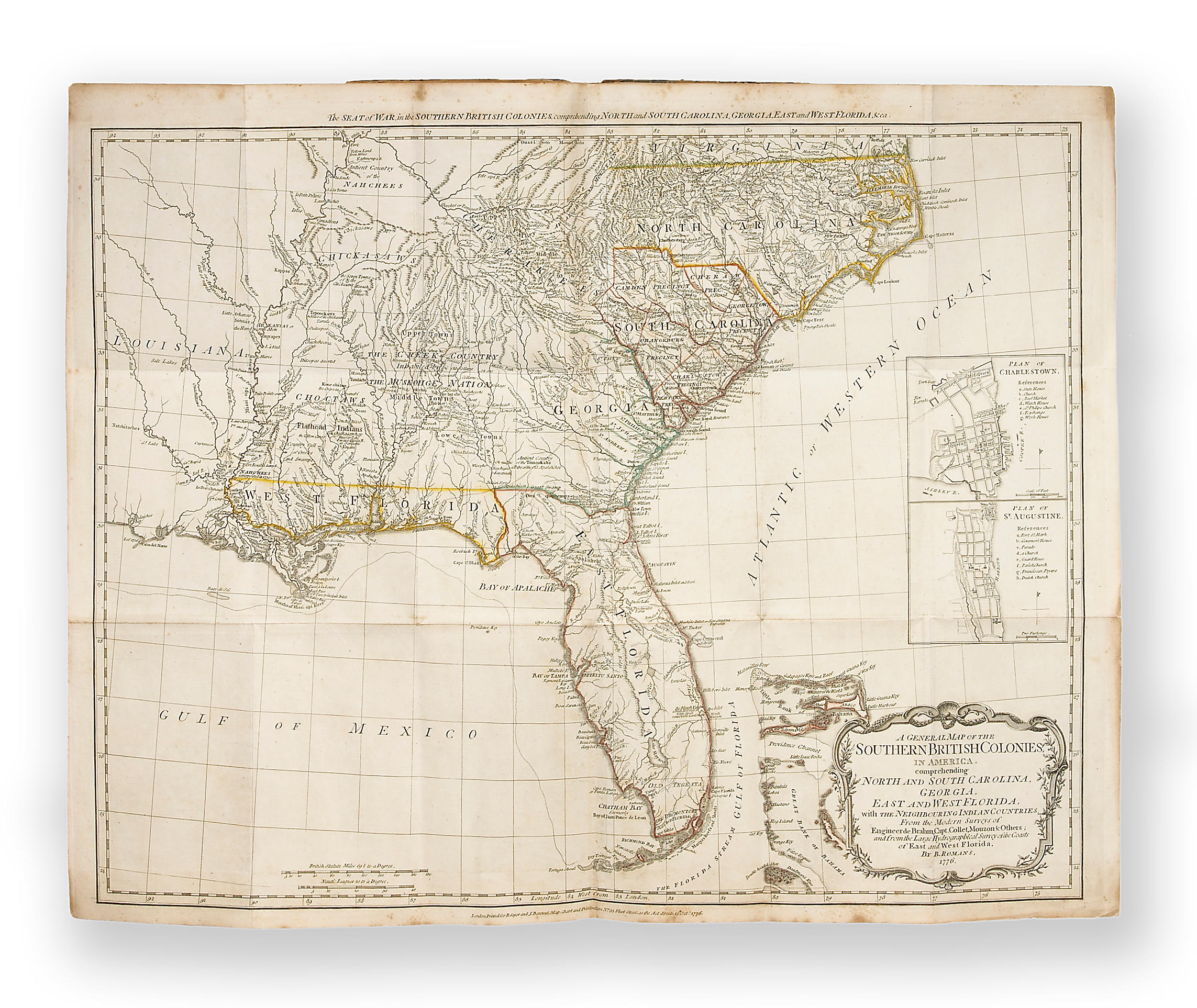
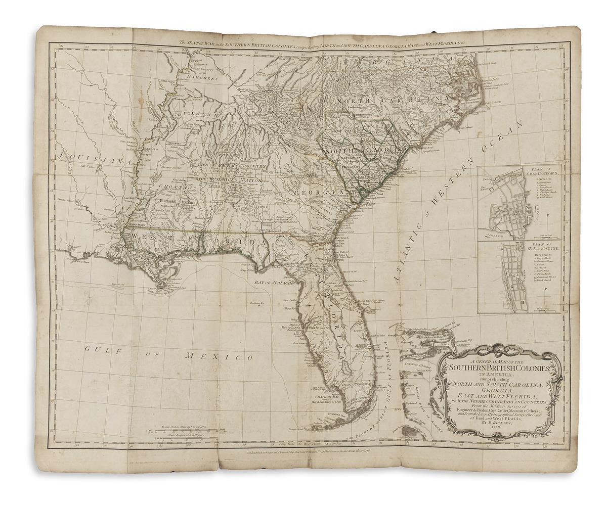
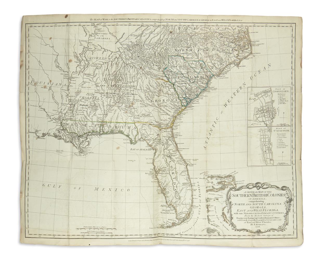
Sayer, Robert, & John Bennet (publishers)The American Military Pocket Atlas; Being An Approved Collection of Correct Maps, Both General and Particular, of the British Colonies. London: Printed for R. Sayer and J. Bennet, 1776 8vo (225 x 142 mm). Letterpress text, title (verso blank), 2- page dedication to "Gov. Pownall," 2pp. "Advertisement," one-page "List of Maps" (verso blank), 6 folding engraved maps, all handcolored in outline, hinges on guards; some toning, offsetting, scattered spotting, splits to folds, minor marginal repairs, tape repairs, some soiling. Original half calf and marbled boards, spine with raised bands in six compartments, second with gilt-lettered leather label; overall rubbed with loss, some restoration to joints. Housed in custom half morocco clamshell case. Maps as follows: 1) Dunn, Samuel. North America, as divided amongst the European Powers. By Samuel Dunn, Mathematician. London: printed for Robt. Sayer, 10 Jany. 1774. Engraved map (343 x 464 mm). Handcolored in outline. Engraved for Dunn's "A New Atlas." — 2) Dunn, Samuel. A compleat map of the West Indies, containing the coasts of Florida, Louisiana, New Spain, and Terra Firma: with all the islands. London: Robt. Sayer, 10 January 1774. Engraved map (337 x 470 mm). Handcolored in outline. Engraved for Dunn's "A New Atlas." — The "Advertisement" describes these first two maps as "a general map of the part of the globe, called North America, and a second general map of those islands, shores, gulfs, and bays, which form what is commonly called the West Indies; these we consider as introductory, and as giving a general idea, and we trust a just one." — 3) A general map of the Northern British Colonies in America. Which comprehends the Province of Quebec, the Government of Newfoundland, Nova-Scotia, New-England and New-York. From the maps published by the Admiralty and Board of Trade, Regulated by the astronomic and trigonometric observations of Major Holland and corrected from Governor Pownall's late Map 1776. London: Robt. Sayer & Jno. Bennet, 14 August 1776. Engraved map (527 x 679 mm). Handcolored in outline. First state, also issued as a separate map. This map was re-issued in 1788 with the title changed to reflect the new political realities. McCorkle, New England 776.11; Sellers & Van Ee 143; Stevens & Tree 65 — 4) Evans, Lewis. A general map of the Middle British Colonies, in America. Containing Virginia, Maryland, the Delaware Counties, Pennsylvania and New Jersey. With the addition of New York, and the greatest part of New England, as also of the bordering parts of the Province of Quebec, improved from several surveys made after the late war, and corrected from Governor Pownall's late Map 1776. London: R. Sayer & J. Bennet, 15 October 1776. Engraved map (521 x 679 mm). Handcolored in outline. Based on Lewis Evans' map of 1755, with additions and corrections. Stephenson & McKee, Virginia p. 82 (an image of the Evans map) — 5) Romans, Bernard. A general map of the Southern British Colonies, in America. Comprehending North and South Carolina, Georgia, East and West Florida, with the neighbouring Indian countries. From the modern surveys of Engineer de Brahm, Capt. Collet, Mouzon & others; and from the large hydrographical survey of the coasts of East and West Florida. By B. Romans. London: R. Sayer & J. Bennett [sic.], 15 Octr. 1776. Engraved map (540 x 660 mm). Handcolored in outline. Based on charts and maps by Roman and others. — 6) Brassier, William Furness. A Survey of Lake Champlain including Lake George, Crown Point and St. John, Surveyed by order of ... Sr. Jeffery Amherst ... by William Brassier, draughtsman. 1762. London: Robt. Sayer & Jno. Bennet, 5 Aug., 1776. Engraved map (711 x 521 mm). Handcolored in outline. Also issued as the first separately published map of Lake Champlain, this excellent detailed chart was based on a survey made during the French and Indian War, but not published until the Revolution. Included is an inset ill
Sayer, Robert, & John Bennet (publishers)The American Military Pocket Atlas; Being An Approved Collection of Correct Maps, Both General and Particular, of the British Colonies. London: Printed for R. Sayer and J. Bennet, 1776 8vo (225 x 142 mm). Letterpress text, title (verso blank), 2- page dedication to "Gov. Pownall," 2pp. "Advertisement," one-page "List of Maps" (verso blank), 6 folding engraved maps, all handcolored in outline, hinges on guards; some toning, offsetting, scattered spotting, splits to folds, minor marginal repairs, tape repairs, some soiling. Original half calf and marbled boards, spine with raised bands in six compartments, second with gilt-lettered leather label; overall rubbed with loss, some restoration to joints. Housed in custom half morocco clamshell case. Maps as follows: 1) Dunn, Samuel. North America, as divided amongst the European Powers. By Samuel Dunn, Mathematician. London: printed for Robt. Sayer, 10 Jany. 1774. Engraved map (343 x 464 mm). Handcolored in outline. Engraved for Dunn's "A New Atlas." — 2) Dunn, Samuel. A compleat map of the West Indies, containing the coasts of Florida, Louisiana, New Spain, and Terra Firma: with all the islands. London: Robt. Sayer, 10 January 1774. Engraved map (337 x 470 mm). Handcolored in outline. Engraved for Dunn's "A New Atlas." — The "Advertisement" describes these first two maps as "a general map of the part of the globe, called North America, and a second general map of those islands, shores, gulfs, and bays, which form what is commonly called the West Indies; these we consider as introductory, and as giving a general idea, and we trust a just one." — 3) A general map of the Northern British Colonies in America. Which comprehends the Province of Quebec, the Government of Newfoundland, Nova-Scotia, New-England and New-York. From the maps published by the Admiralty and Board of Trade, Regulated by the astronomic and trigonometric observations of Major Holland and corrected from Governor Pownall's late Map 1776. London: Robt. Sayer & Jno. Bennet, 14 August 1776. Engraved map (527 x 679 mm). Handcolored in outline. First state, also issued as a separate map. This map was re-issued in 1788 with the title changed to reflect the new political realities. McCorkle, New England 776.11; Sellers & Van Ee 143; Stevens & Tree 65 — 4) Evans, Lewis. A general map of the Middle British Colonies, in America. Containing Virginia, Maryland, the Delaware Counties, Pennsylvania and New Jersey. With the addition of New York, and the greatest part of New England, as also of the bordering parts of the Province of Quebec, improved from several surveys made after the late war, and corrected from Governor Pownall's late Map 1776. London: R. Sayer & J. Bennet, 15 October 1776. Engraved map (521 x 679 mm). Handcolored in outline. Based on Lewis Evans' map of 1755, with additions and corrections. Stephenson & McKee, Virginia p. 82 (an image of the Evans map) — 5) Romans, Bernard. A general map of the Southern British Colonies, in America. Comprehending North and South Carolina, Georgia, East and West Florida, with the neighbouring Indian countries. From the modern surveys of Engineer de Brahm, Capt. Collet, Mouzon & others; and from the large hydrographical survey of the coasts of East and West Florida. By B. Romans. London: R. Sayer & J. Bennett [sic.], 15 Octr. 1776. Engraved map (540 x 660 mm). Handcolored in outline. Based on charts and maps by Roman and others. — 6) Brassier, William Furness. A Survey of Lake Champlain including Lake George, Crown Point and St. John, Surveyed by order of ... Sr. Jeffery Amherst ... by William Brassier, draughtsman. 1762. London: Robt. Sayer & Jno. Bennet, 5 Aug., 1776. Engraved map (711 x 521 mm). Handcolored in outline. Also issued as the first separately published map of Lake Champlain, this excellent detailed chart was based on a survey made during the French and Indian War, but not published until the Revolution. Included is an inset ill


Testen Sie LotSearch und seine Premium-Features 7 Tage - ohne Kosten!
Lassen Sie sich automatisch über neue Objekte in kommenden Auktionen benachrichtigen.
Suchauftrag anlegen