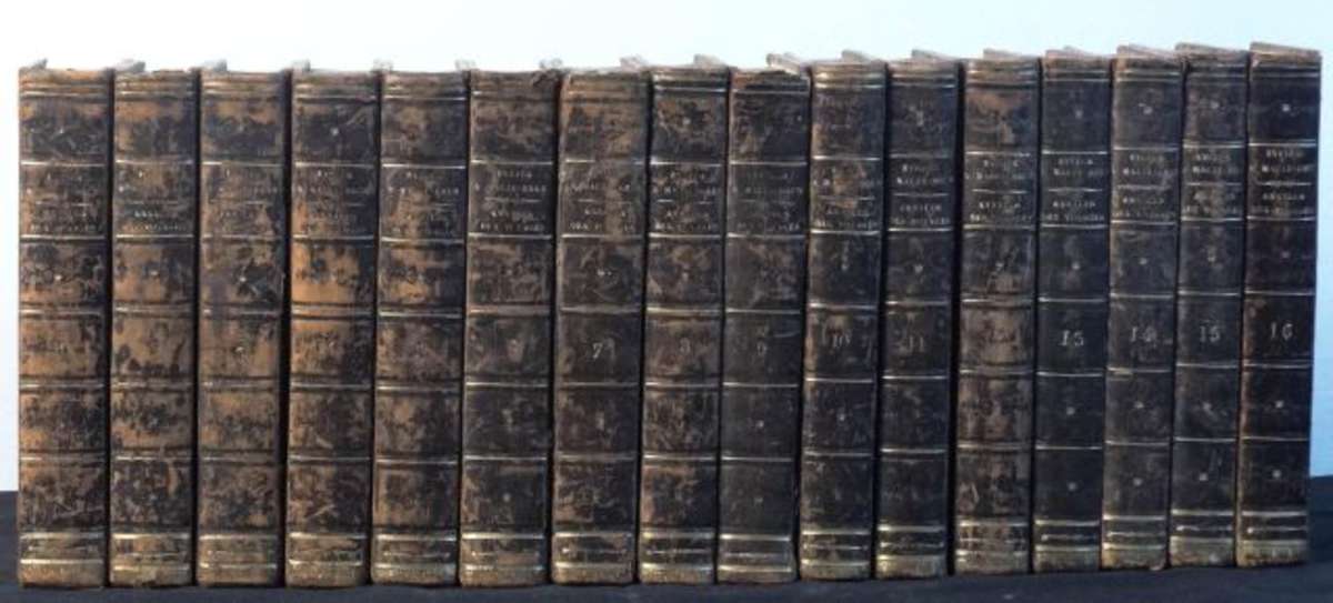
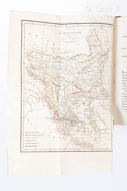
Title: Nouvelles Annales Des Voyages, de la Géographie et de L'Histoire, ou Recueil... avec des cartes et planches, gravées en taille-douce Author: Eyris, J.B. and Malte-Brun Place: Paris Publisher: Librairie de Gide Fils Date: 1821 Description: Volumes 10, 11 & 12 (of about 185). 416, [4]; 416; 420, [3] pp. With 4 (of 5) folding engraved maps. (12mo) 18.6x12 cm (7¼x4¾"), original boards, spines gilt, morocco lettering pieces. Three significant volumes in this voluminous set on voyages and exploration, The most important articles in the three volumes, and indeed likely in the entire 185 or so volumes in the set, are the articles in volumes 10 and 12 which contain reports Wilson Price Hunt and Robert Stuart on there travels in Western America in the course of the fur trade. Volume 12 contains the important map by Lapie illustrating their explorations and the discovery of what was to be the Oregon Trail. Wheat calls this "The first map of importance to appear in 1821... It was published in Nouvelle Annales des Voyages... and purports to show the routes of Wilson Price Hunt (westward) and Robert Stuart (eastward) a decade earlier. The map is well constructed, and has been praised as a remarkably accurate representation of their journeyings. It seems to have been largely based on the Lewis and Clark map of 1814, but in its new elements it was a notable performance... Lapie's rendition of the Snake and its tributaries was a notable advance over any map that had yet been constructed..." The four maps present in the three volumes are: Coupe du Desert d'orient et occident. 38.5x23 cm (North Africa) Carte de la Route du Capitaine G.F. Lyon à travers ;a Règence de Tripoli et le Royaume de Fezzan. 65x36 cm Carte d'une Partie de l'Ocèan Artique et de l'Amérique Septentrionale, our expliquer d'après les relations de Maldonado, de l'Amiral de Fonte... 32x44 cm (detached, darkened along one fold) Carte de la Parte Occidentale des États-Unis, Dressée pour servir à l'intelligence des découvertes des Américains dans cette partie et notamment pour celles de M.M. Hunt et Stuart, faites in 1811,12, et 13. 23.8x43 cm The latter two maps are by Lapie. Provenance: Ruderman, 10/01 References: for Hunt and Stuart, vols 10 and 12: WC 19. W-TW 343, Vol 2, pp 73-76. for Lapie, vol 11: Brietfuss, "Early Maps of North-Eastern Asia and of the Land around the North Pacific" in Imago Mundi, Vol 3, pp 87-99. The Hunt portion of text is published in translation in The Overland Diary of Wilson Price Hunt, Oregon Book Society, 1973. The Stuart portion of text is published in translation in The Discovery of the Oregon Trail, Eberstadt. 1935 and also, Scribner 1935. Re the Lapie article and map, Brietfuss puts Lapie in the French tradition of using imaginative cartography to show a Northwest Passage. Lot Amendments Condition: Some rubbing and wear to boards; Hunt and Price map with light soiling in top margin only, else quite clean; the three volumes very good overall. Item number: 271063
Title: Nouvelles Annales Des Voyages, de la Géographie et de L'Histoire, ou Recueil... avec des cartes et planches, gravées en taille-douce Author: Eyris, J.B. and Malte-Brun Place: Paris Publisher: Librairie de Gide Fils Date: 1821 Description: Volumes 10, 11 & 12 (of about 185). 416, [4]; 416; 420, [3] pp. With 4 (of 5) folding engraved maps. (12mo) 18.6x12 cm (7¼x4¾"), original boards, spines gilt, morocco lettering pieces. Three significant volumes in this voluminous set on voyages and exploration, The most important articles in the three volumes, and indeed likely in the entire 185 or so volumes in the set, are the articles in volumes 10 and 12 which contain reports Wilson Price Hunt and Robert Stuart on there travels in Western America in the course of the fur trade. Volume 12 contains the important map by Lapie illustrating their explorations and the discovery of what was to be the Oregon Trail. Wheat calls this "The first map of importance to appear in 1821... It was published in Nouvelle Annales des Voyages... and purports to show the routes of Wilson Price Hunt (westward) and Robert Stuart (eastward) a decade earlier. The map is well constructed, and has been praised as a remarkably accurate representation of their journeyings. It seems to have been largely based on the Lewis and Clark map of 1814, but in its new elements it was a notable performance... Lapie's rendition of the Snake and its tributaries was a notable advance over any map that had yet been constructed..." The four maps present in the three volumes are: Coupe du Desert d'orient et occident. 38.5x23 cm (North Africa) Carte de la Route du Capitaine G.F. Lyon à travers ;a Règence de Tripoli et le Royaume de Fezzan. 65x36 cm Carte d'une Partie de l'Ocèan Artique et de l'Amérique Septentrionale, our expliquer d'après les relations de Maldonado, de l'Amiral de Fonte... 32x44 cm (detached, darkened along one fold) Carte de la Parte Occidentale des États-Unis, Dressée pour servir à l'intelligence des découvertes des Américains dans cette partie et notamment pour celles de M.M. Hunt et Stuart, faites in 1811,12, et 13. 23.8x43 cm The latter two maps are by Lapie. Provenance: Ruderman, 10/01 References: for Hunt and Stuart, vols 10 and 12: WC 19. W-TW 343, Vol 2, pp 73-76. for Lapie, vol 11: Brietfuss, "Early Maps of North-Eastern Asia and of the Land around the North Pacific" in Imago Mundi, Vol 3, pp 87-99. The Hunt portion of text is published in translation in The Overland Diary of Wilson Price Hunt, Oregon Book Society, 1973. The Stuart portion of text is published in translation in The Discovery of the Oregon Trail, Eberstadt. 1935 and also, Scribner 1935. Re the Lapie article and map, Brietfuss puts Lapie in the French tradition of using imaginative cartography to show a Northwest Passage. Lot Amendments Condition: Some rubbing and wear to boards; Hunt and Price map with light soiling in top margin only, else quite clean; the three volumes very good overall. Item number: 271063


Testen Sie LotSearch und seine Premium-Features 7 Tage - ohne Kosten!
Lassen Sie sich automatisch über neue Objekte in kommenden Auktionen benachrichtigen.
Suchauftrag anlegen