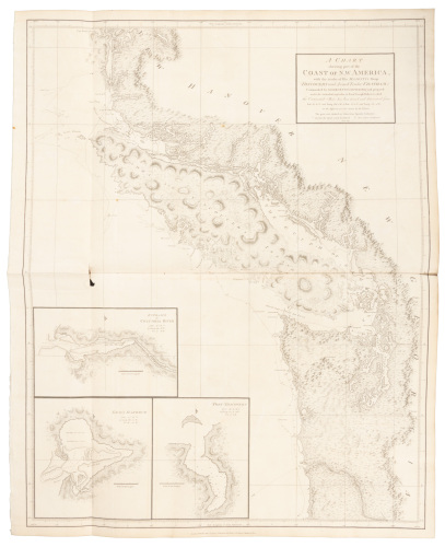
16 engraved maps of the showing the Northwest Coast of America and the Northeast Coasts of Asia and Russia, late 18th and early 19th centuries, 197 x 258 to 485 x 636 mm, several hand-colored, including: 1. DELISLE, GUILLAUME. Carte ... au commencement de ce Siècle, pour servir à ses conjectures sur l'éxistence de la Mer de l'Ouest [with] Carte dressée sur la lettre de l'Amiral de Fonte, par l'écrivain de la Californie. Paris: November 1752. 2 maps on 1 sheet,184 x 151 mm and 187 x 168 mm, tipped to mat. 2. BAARSEL, C. VAN. Kaart van de noord-west kust van Amerika en de noord-oost kust van Asia. Opgenoomen in de Jaaren 1778 en 1779. [Leiden: c.1790.] 378 X 644 mm, on heavy paper, folding creases. Showing Cook's soundings in the Bering Strait during his third voyage. 3. BELLIN, JACQUES NICOLAS Carte réduite des découvertes des Russes entre l'Asie et l'Amérique, pour servir à l'histoire générale des voyages. Paris: 1764. 197 x 286 mm, decorative cartouche, pictorial relief, slight browning. A fine example of a rare map.
16 engraved maps of the showing the Northwest Coast of America and the Northeast Coasts of Asia and Russia, late 18th and early 19th centuries, 197 x 258 to 485 x 636 mm, several hand-colored, including: 1. DELISLE, GUILLAUME. Carte ... au commencement de ce Siècle, pour servir à ses conjectures sur l'éxistence de la Mer de l'Ouest [with] Carte dressée sur la lettre de l'Amiral de Fonte, par l'écrivain de la Californie. Paris: November 1752. 2 maps on 1 sheet,184 x 151 mm and 187 x 168 mm, tipped to mat. 2. BAARSEL, C. VAN. Kaart van de noord-west kust van Amerika en de noord-oost kust van Asia. Opgenoomen in de Jaaren 1778 en 1779. [Leiden: c.1790.] 378 X 644 mm, on heavy paper, folding creases. Showing Cook's soundings in the Bering Strait during his third voyage. 3. BELLIN, JACQUES NICOLAS Carte réduite des découvertes des Russes entre l'Asie et l'Amérique, pour servir à l'histoire générale des voyages. Paris: 1764. 197 x 286 mm, decorative cartouche, pictorial relief, slight browning. A fine example of a rare map.


Testen Sie LotSearch und seine Premium-Features 7 Tage - ohne Kosten!
Lassen Sie sich automatisch über neue Objekte in kommenden Auktionen benachrichtigen.
Suchauftrag anlegen