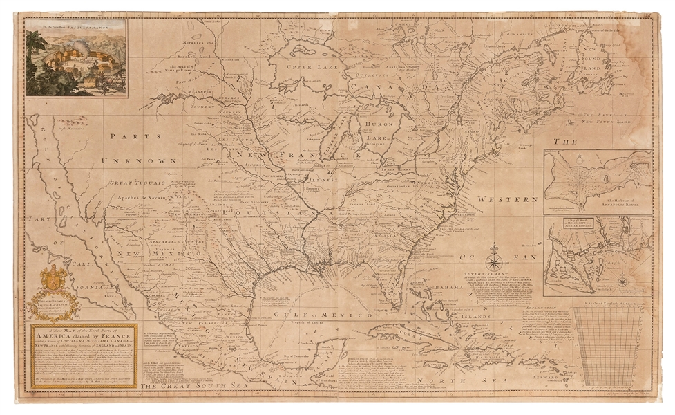
A New and Exact Map of the Dominions of the King of Great Britain... Containing Newfoundland, New Scotland, New England, New York, New Jersey, Pensilvania, Maryland, Virginia and Carolina. According to the Newest and most exact observations by Herman Moll Geographer. Dublin: George Grierson, [c.1735]. Engraved map, on two joined sheets, 1010 x 612 mm, hand-colored in outline, elaborate cartouche in lower center with dedication to Duke Gardiner, five inset maps or scenes added in lower portion, including "A Map of the Improved Part of Carolina," "A Map of the Principal Part of North America," "A View of ye Industry of Beavers in Canada," "A Draught of ye Town and Harbour of Charles-Town," and a map of Louisiana and East Florida. Mounted on linen, occasional minor chipping along folds, some minor staining. Second edition. The rare Irish re-engraving of Moll's famous "Beaver Map," one of the first large maps printed in Ireland. "Moll's map focused on English counter-claims to French-occupied territories" (Latitude). The map highlights the postal routes throughout the British territories and is generally thought to be the first postal map of the colonies. In sections of text Moll describes the Iroquois along the Appalachian Mountains as "...hearty friends to the English..." Degrees of Latitude 19; Kershaw II:331; Tooley The Mapping of America 55.
A New and Exact Map of the Dominions of the King of Great Britain... Containing Newfoundland, New Scotland, New England, New York, New Jersey, Pensilvania, Maryland, Virginia and Carolina. According to the Newest and most exact observations by Herman Moll Geographer. Dublin: George Grierson, [c.1735]. Engraved map, on two joined sheets, 1010 x 612 mm, hand-colored in outline, elaborate cartouche in lower center with dedication to Duke Gardiner, five inset maps or scenes added in lower portion, including "A Map of the Improved Part of Carolina," "A Map of the Principal Part of North America," "A View of ye Industry of Beavers in Canada," "A Draught of ye Town and Harbour of Charles-Town," and a map of Louisiana and East Florida. Mounted on linen, occasional minor chipping along folds, some minor staining. Second edition. The rare Irish re-engraving of Moll's famous "Beaver Map," one of the first large maps printed in Ireland. "Moll's map focused on English counter-claims to French-occupied territories" (Latitude). The map highlights the postal routes throughout the British territories and is generally thought to be the first postal map of the colonies. In sections of text Moll describes the Iroquois along the Appalachian Mountains as "...hearty friends to the English..." Degrees of Latitude 19; Kershaw II:331; Tooley The Mapping of America 55.


.jpg)


.jpg)


Testen Sie LotSearch und seine Premium-Features 7 Tage - ohne Kosten!
Lassen Sie sich automatisch über neue Objekte in kommenden Auktionen benachrichtigen.
Suchauftrag anlegen