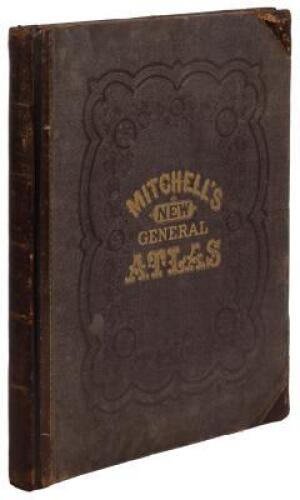
Title: Mitchell's New General Atlas, Containing Maps of the Various Countries of the World, Plans of Cities, Etc., Embraced in Sixty-Three Quarto Maps... Author: Mitchell, S[amuel] Augustus, Jr. Place: Philadelphia Publisher: S. Augustus Mitchell, Jr. Date: 1869 Description: With 64 hand-colored maps and plans (7 are double-page), plus many insets, all on 57 mapsheets; hand-colored Time Table leaf. 15¼x12½, original quarter brown sheep and blind-stamped cloth, front cover lettered in gilt. Double-page maps comprise of: The World; United States; New York (state); New York City and Brooklyn; States of Arkansas, Mississippi and Louisiana; Mexico, Central America and the West Indies. Most of the maps pertain to the Americas, chiefly U.S. states and cities, such as: New York, Boston, Philadelphia, Baltimore, Washington DC, New Orleans, Cincinnati, Chicago, St. Louis, Texas, California, Minnesota, Maine and others. World maps include: Europe, Russia, France, Spain, Portugal, Switzerland, Ireland, Asia, Africa, etc. List of the U.S. and Canadian post offices, U.S. populations, governments, distances, and the mountains and rivers of the world, all in the back. Lot Amendments Condition: Edge wear, leather scuffed, a few frays (including to spine ends and corners); binding loose with front hinge cracked through, occasional light foxing and small marginal stains, otherwise most maps near fine; binding needs repair. Item number: 144366
Title: Mitchell's New General Atlas, Containing Maps of the Various Countries of the World, Plans of Cities, Etc., Embraced in Sixty-Three Quarto Maps... Author: Mitchell, S[amuel] Augustus, Jr. Place: Philadelphia Publisher: S. Augustus Mitchell, Jr. Date: 1869 Description: With 64 hand-colored maps and plans (7 are double-page), plus many insets, all on 57 mapsheets; hand-colored Time Table leaf. 15¼x12½, original quarter brown sheep and blind-stamped cloth, front cover lettered in gilt. Double-page maps comprise of: The World; United States; New York (state); New York City and Brooklyn; States of Arkansas, Mississippi and Louisiana; Mexico, Central America and the West Indies. Most of the maps pertain to the Americas, chiefly U.S. states and cities, such as: New York, Boston, Philadelphia, Baltimore, Washington DC, New Orleans, Cincinnati, Chicago, St. Louis, Texas, California, Minnesota, Maine and others. World maps include: Europe, Russia, France, Spain, Portugal, Switzerland, Ireland, Asia, Africa, etc. List of the U.S. and Canadian post offices, U.S. populations, governments, distances, and the mountains and rivers of the world, all in the back. Lot Amendments Condition: Edge wear, leather scuffed, a few frays (including to spine ends and corners); binding loose with front hinge cracked through, occasional light foxing and small marginal stains, otherwise most maps near fine; binding needs repair. Item number: 144366


Testen Sie LotSearch und seine Premium-Features 7 Tage - ohne Kosten!
Lassen Sie sich automatisch über neue Objekte in kommenden Auktionen benachrichtigen.
Suchauftrag anlegen