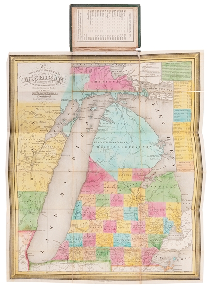
[MITCHELL, Samuel Augustus (1790–1868)]. –– YOUNG, J. H. The Tourist’s Pocket Map of the State of Illinois Exhibiting its Internal Improvements, Roads, Distances &c. Philadelphia: S. Augustus Mitchell, 1835. 16mo. Engraved folding map (394 x 324 mm), hand–colored after Young by E. F. Woodward. Housed within original red straight–grain morocco covers lettered in gilt, original “Public Lands” printed label on front pastedown, publisher’s printed label on rear pastedown. Published just 2 years after the founding of Chicago, this pocket map depicts an early view Illinois showing surveyed townships, geographic features, and major industries including an inset map of the Galena mine region. Side tables show steamboat routes and population statistics as of 1830 with a dwindling number of slaves which would later be outlawed in 1848. AN ATTRACTIVE COPY.
[MITCHELL, Samuel Augustus (1790–1868)]. –– YOUNG, J. H. The Tourist’s Pocket Map of the State of Illinois Exhibiting its Internal Improvements, Roads, Distances &c. Philadelphia: S. Augustus Mitchell, 1835. 16mo. Engraved folding map (394 x 324 mm), hand–colored after Young by E. F. Woodward. Housed within original red straight–grain morocco covers lettered in gilt, original “Public Lands” printed label on front pastedown, publisher’s printed label on rear pastedown. Published just 2 years after the founding of Chicago, this pocket map depicts an early view Illinois showing surveyed townships, geographic features, and major industries including an inset map of the Galena mine region. Side tables show steamboat routes and population statistics as of 1830 with a dwindling number of slaves which would later be outlawed in 1848. AN ATTRACTIVE COPY.


Try LotSearch and its premium features for 7 days - without any costs!
Be notified automatically about new items in upcoming auctions.
Create an alert