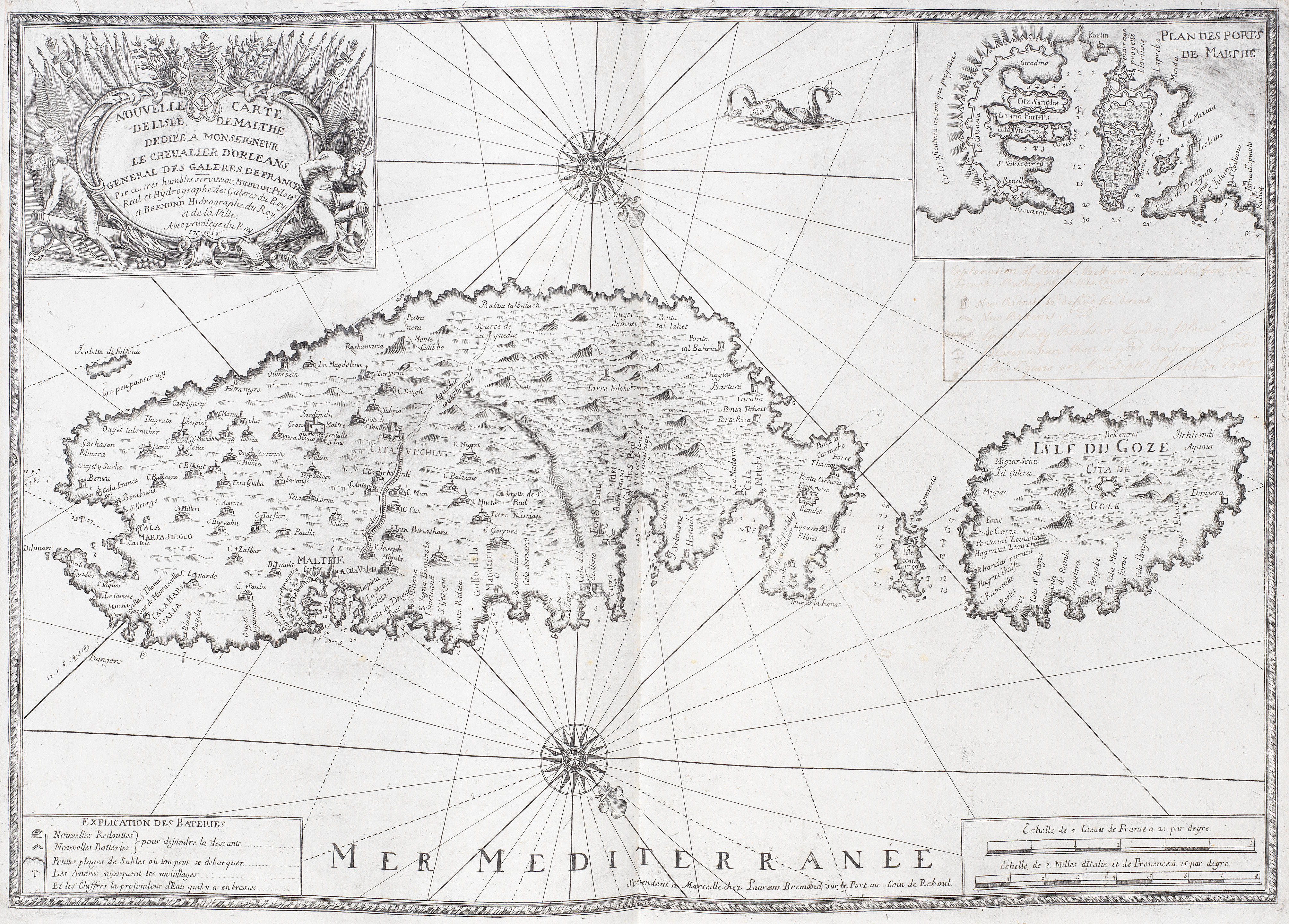
MICHELOT, Henri and Laurent, BREMOND. Marseille: [n.p., 1715-1726]. [A collection of 16 charts of the Mediterranean]. 2° (504 x 260mm). 16 double-page engraved charts, one folding, double-page engraved plate. (Occasional soiling and waterstaining, a few tiny holes.) 18th-century calf, small gilt foliate corner pieces, blue edges (lacking ties, rubbed, spine lightly soiled). Provenance : Agostino Millelire (ownership inscription, Commander in 1815, La Maddalena, Italy) -- Giovan Battista Millelire (ownership inscription, 1803-1866, Rear Admiral, La Maddalena, Italy) -- early inscription on back cover. FIRST EDITION. The charts are dated between 1715 and 1728 and the work is exceptionally detailed demonstrating the skill of Peter Starckmann, one of the most sought after map engravers of the period who signed some of the maps. Chart coverage includes the coasts of Europe and Africa (Barbarie) from the Strait of Gibraltar and Ceuta in the west through Marbella, Malaga, Almeria and Cartagena to Cap Palle in the east. Dozens of guard towers are noted along the coast; they would have been crucial during that era of intense raiding from the Barbary coast. Other maps include: San Lucar de Barameda, Rota, Cape Trafalgar, Ceuta, Tangiers, Tarifa, Gibraltar, Puerto Santa Maria and the hills of Medina Sidonia. Shirley BL M.MICH-1c.
MICHELOT, Henri and Laurent, BREMOND. Marseille: [n.p., 1715-1726]. [A collection of 16 charts of the Mediterranean]. 2° (504 x 260mm). 16 double-page engraved charts, one folding, double-page engraved plate. (Occasional soiling and waterstaining, a few tiny holes.) 18th-century calf, small gilt foliate corner pieces, blue edges (lacking ties, rubbed, spine lightly soiled). Provenance : Agostino Millelire (ownership inscription, Commander in 1815, La Maddalena, Italy) -- Giovan Battista Millelire (ownership inscription, 1803-1866, Rear Admiral, La Maddalena, Italy) -- early inscription on back cover. FIRST EDITION. The charts are dated between 1715 and 1728 and the work is exceptionally detailed demonstrating the skill of Peter Starckmann, one of the most sought after map engravers of the period who signed some of the maps. Chart coverage includes the coasts of Europe and Africa (Barbarie) from the Strait of Gibraltar and Ceuta in the west through Marbella, Malaga, Almeria and Cartagena to Cap Palle in the east. Dozens of guard towers are noted along the coast; they would have been crucial during that era of intense raiding from the Barbary coast. Other maps include: San Lucar de Barameda, Rota, Cape Trafalgar, Ceuta, Tangiers, Tarifa, Gibraltar, Puerto Santa Maria and the hills of Medina Sidonia. Shirley BL M.MICH-1c.
.jpg)
.jpg?w=400)

.jpg)


Testen Sie LotSearch und seine Premium-Features 7 Tage - ohne Kosten!
Lassen Sie sich automatisch über neue Objekte in kommenden Auktionen benachrichtigen.
Suchauftrag anlegen