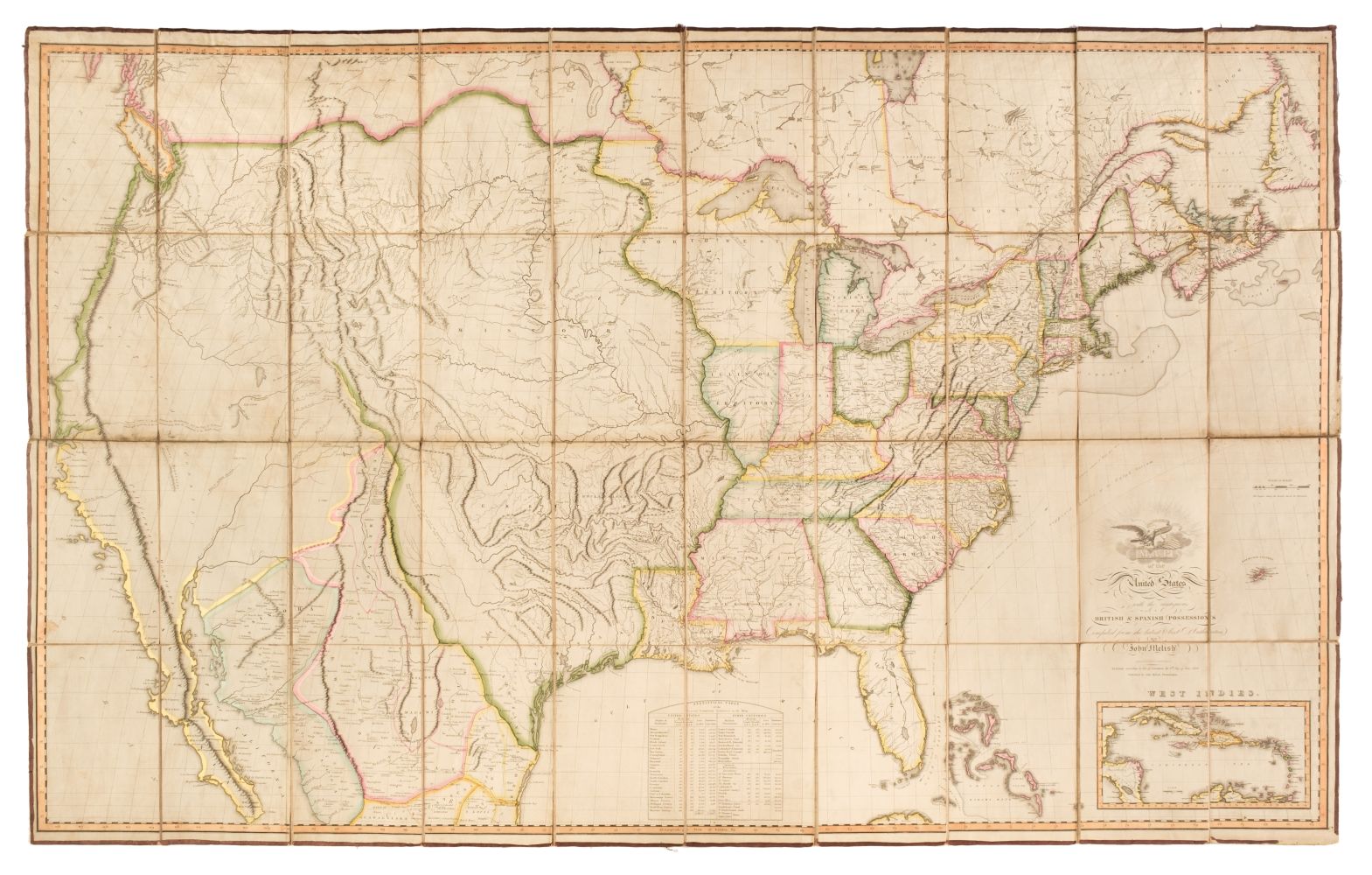
MELISH, John (1771-1822). Map of the United States with the contiguous British & Spanish Possessions Compiled from the latest & best authorities. Philadelphia: John Melish, 1816. Engraved folding map by J. Vallance and H.S. Tanner, dissected in 40 sections and mounted on linen, edged in green cloth, colored in outline, 912 x 1475 mm (a few small tears/nicks, otherwise very fresh and clean). Folds with marbled end sheets in contemporary blue straight-grained morocco pull off case. THE FIRST AMERICAN-PRODUCED WALL MAP DEPICTING THE COUNTRY FROM COAST TO COAST. Apparently the fourth state, with Cadiz, Washington, Cambridge, Adelphi, Mansfield and Wooster added in Ohio and "Vevay or" added before "Swiss Vineyards" in southeastern Indiana. "An exquisite map, it distinguished Melish as the leading American map publisher of the second decade and placed American map publisher of the second decade and placed American maps on equal footing with those produced by the prestigious firms in London and Paris. Incorporating data from state and military maps as these became available, Melish frequently revised and corrected the plates, limiting each printing to 100 copies" (Seymour I Schwartz and Ralph E. Ehrenberg, The Mapping of America , Edison, NJ, 2001, p.238). Martin/Ristow 24; Streeter VI:3798. [ With: ] MELISH, John. A Geographical Description of the United States, with the Contiguous British and Spanish Possessions, intended as an Accompaniment to Melish's Map of these Countries . Philadelphia: T.H. Palmer for the Author, 1816. 8 o (206 x 126 mm). 5 engraved maps, one folding and hand-colored (some spotting). Contemporary red roan-backed marbled boards (some wear at extremities). Second edition. Howes M490; Sabin 47431. (2)
MELISH, John (1771-1822). Map of the United States with the contiguous British & Spanish Possessions Compiled from the latest & best authorities. Philadelphia: John Melish, 1816. Engraved folding map by J. Vallance and H.S. Tanner, dissected in 40 sections and mounted on linen, edged in green cloth, colored in outline, 912 x 1475 mm (a few small tears/nicks, otherwise very fresh and clean). Folds with marbled end sheets in contemporary blue straight-grained morocco pull off case. THE FIRST AMERICAN-PRODUCED WALL MAP DEPICTING THE COUNTRY FROM COAST TO COAST. Apparently the fourth state, with Cadiz, Washington, Cambridge, Adelphi, Mansfield and Wooster added in Ohio and "Vevay or" added before "Swiss Vineyards" in southeastern Indiana. "An exquisite map, it distinguished Melish as the leading American map publisher of the second decade and placed American map publisher of the second decade and placed American maps on equal footing with those produced by the prestigious firms in London and Paris. Incorporating data from state and military maps as these became available, Melish frequently revised and corrected the plates, limiting each printing to 100 copies" (Seymour I Schwartz and Ralph E. Ehrenberg, The Mapping of America , Edison, NJ, 2001, p.238). Martin/Ristow 24; Streeter VI:3798. [ With: ] MELISH, John. A Geographical Description of the United States, with the Contiguous British and Spanish Possessions, intended as an Accompaniment to Melish's Map of these Countries . Philadelphia: T.H. Palmer for the Author, 1816. 8 o (206 x 126 mm). 5 engraved maps, one folding and hand-colored (some spotting). Contemporary red roan-backed marbled boards (some wear at extremities). Second edition. Howes M490; Sabin 47431. (2)


.jpg)
Try LotSearch and its premium features for 7 days - without any costs!
Be notified automatically about new items in upcoming auctions.
Create an alert