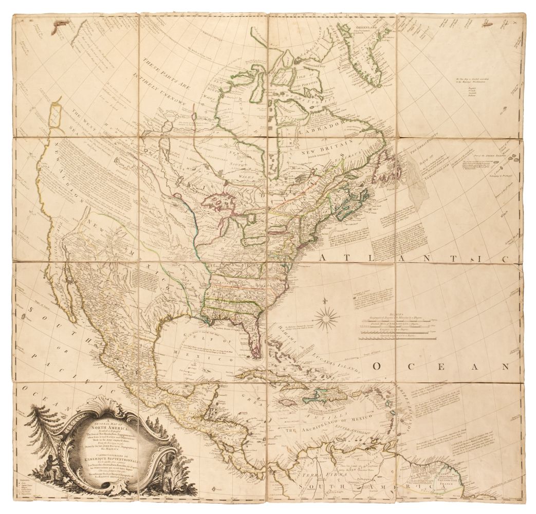
Title: Map of North America exhibiting the recent discoveries, geographical and nautical; drawn chiefly from the authorities M. de Humbolt, Lieut. Pike, Mess. Lewis and Clarke, Sir Alex. Mackenzie, Mr. Hearne, Col. Bouchette, Capt. Vancouver, Ross, Parry & Franklin. also describing the boundary lines between the territories of Great Britain the United States, and the Mexican and Central States. Author: Wyld, James Place: London Publisher: Date: 1825 Description: Copper-engraved map, hand-colored in outline. On six sheets joined into three, plus southern extension on the bottom sheet. Each of the joined sheets approx. 48x164 cm (18¾x64½"); overall approx. 144x164 cm (56¾x64½") plus the southern extension, which measures approx. 31.5x79 cm (12¾x31"), and covers southern Mexico and Central America. Large, striking, and rare issue of Wyld's North America, Warren Heckrotte notes that "The elaborate and erroneous mountain ranges in what is now western United States appear to derive from the map of Dr. John Robinson Map of Mexico, Louisiana and Missouri Territory, 1819 [Wheat 334]. Wyld used portions of this map with little change for many years." OCLC/WorldCat lists only one example of this 1825 issue, at the University of Oxford. Provenance: Radford, 3/79 References: Stevens-Tree, Comparative Cartography, No 63, lists 4 editions, the first 1824, but not this edition; the latest is 1856. W-TW 366. W-GR 5. Phillips, Maps of America, lists an edition of 1823 which the other references do not have.This edition has the words "from 20º to 80º" after "America". This map used Faden's map of 1820 with the same title. Wyld took over Faden's business. Lot Amendments Condition: Some offsetting, some crease tears and other tears repaired with tape on verso, a few short splits not repaired; very good overall, an impressive and captivating map. Item number: 269947
Title: Map of North America exhibiting the recent discoveries, geographical and nautical; drawn chiefly from the authorities M. de Humbolt, Lieut. Pike, Mess. Lewis and Clarke, Sir Alex. Mackenzie, Mr. Hearne, Col. Bouchette, Capt. Vancouver, Ross, Parry & Franklin. also describing the boundary lines between the territories of Great Britain the United States, and the Mexican and Central States. Author: Wyld, James Place: London Publisher: Date: 1825 Description: Copper-engraved map, hand-colored in outline. On six sheets joined into three, plus southern extension on the bottom sheet. Each of the joined sheets approx. 48x164 cm (18¾x64½"); overall approx. 144x164 cm (56¾x64½") plus the southern extension, which measures approx. 31.5x79 cm (12¾x31"), and covers southern Mexico and Central America. Large, striking, and rare issue of Wyld's North America, Warren Heckrotte notes that "The elaborate and erroneous mountain ranges in what is now western United States appear to derive from the map of Dr. John Robinson Map of Mexico, Louisiana and Missouri Territory, 1819 [Wheat 334]. Wyld used portions of this map with little change for many years." OCLC/WorldCat lists only one example of this 1825 issue, at the University of Oxford. Provenance: Radford, 3/79 References: Stevens-Tree, Comparative Cartography, No 63, lists 4 editions, the first 1824, but not this edition; the latest is 1856. W-TW 366. W-GR 5. Phillips, Maps of America, lists an edition of 1823 which the other references do not have.This edition has the words "from 20º to 80º" after "America". This map used Faden's map of 1820 with the same title. Wyld took over Faden's business. Lot Amendments Condition: Some offsetting, some crease tears and other tears repaired with tape on verso, a few short splits not repaired; very good overall, an impressive and captivating map. Item number: 269947


Testen Sie LotSearch und seine Premium-Features 7 Tage - ohne Kosten!
Lassen Sie sich automatisch über neue Objekte in kommenden Auktionen benachrichtigen.
Suchauftrag anlegen