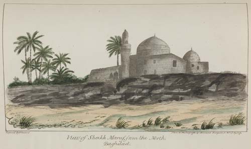
Jones, James Felix VESTIGES OF ASSYRIA... FROM TRIGONOMETRICAL SURVEY IN THE SPRING OF 1852. LONDON: JOHN WALKER FEBY 1855, 3 FOLDING HAND-COLOURED ENGRAVED MAPS, EACH 1260 X 730MM., DISSECTED AND BACKED ON LINEN, BLUE CLOTH EDGES Ibid. Notes on the Topography of Nineveh, and the other Cities of Assyria; and on the General Geography of the Country between the Tigris and the Upper Zab. Founded upon a Trigonometrical Survey made in 1852 at the Command of the Government of India. London: [Privately printed], 1855, FIRST EDITION, 8vo (215 x 126mm.), [ii], 102pp., folding printed table, contemporary black cross-grained morocco gilt with title on upper cover, full gilt unlettered spine, raised flat bands, gilt and coloured endpapers, gilt edges the maps and text housed together in a contemporary black cross-grained morocco gilt book-box (matching the text binding), gilt spine with royal coat of arms, gilt edges Jones (1813/14-1878) was a surveyor and skilled draughtsman who undertook important surveys of the northern part of the Red Sea (1829-1834), and from 1840 in Mesopotamia, including the Tigris and Euphrates rivers, the border with Persia, the mapping of Bagdad on a large scale, and the examination of an alternative overland route between the Gulf of Alexandretta and the Persian Gulf. "In 1852 he made a trigonometrical survey of the country between the Tigris and the upper Zab, including the ruins of Nineveh, the results of which are recorded in a series of maps of Assyrian Vestiges, and the accompanying memoir" (ODNB). This printing of the memoir (i.e. Notes on the Topography of Nineveh) appears to be unrecorded. It was reprinted in Selections from the Records of the Bombay Government (pp.403-500, 1857 - see lot 696 - though without the maps).
Jones, James Felix VESTIGES OF ASSYRIA... FROM TRIGONOMETRICAL SURVEY IN THE SPRING OF 1852. LONDON: JOHN WALKER FEBY 1855, 3 FOLDING HAND-COLOURED ENGRAVED MAPS, EACH 1260 X 730MM., DISSECTED AND BACKED ON LINEN, BLUE CLOTH EDGES Ibid. Notes on the Topography of Nineveh, and the other Cities of Assyria; and on the General Geography of the Country between the Tigris and the Upper Zab. Founded upon a Trigonometrical Survey made in 1852 at the Command of the Government of India. London: [Privately printed], 1855, FIRST EDITION, 8vo (215 x 126mm.), [ii], 102pp., folding printed table, contemporary black cross-grained morocco gilt with title on upper cover, full gilt unlettered spine, raised flat bands, gilt and coloured endpapers, gilt edges the maps and text housed together in a contemporary black cross-grained morocco gilt book-box (matching the text binding), gilt spine with royal coat of arms, gilt edges Jones (1813/14-1878) was a surveyor and skilled draughtsman who undertook important surveys of the northern part of the Red Sea (1829-1834), and from 1840 in Mesopotamia, including the Tigris and Euphrates rivers, the border with Persia, the mapping of Bagdad on a large scale, and the examination of an alternative overland route between the Gulf of Alexandretta and the Persian Gulf. "In 1852 he made a trigonometrical survey of the country between the Tigris and the upper Zab, including the ruins of Nineveh, the results of which are recorded in a series of maps of Assyrian Vestiges, and the accompanying memoir" (ODNB). This printing of the memoir (i.e. Notes on the Topography of Nineveh) appears to be unrecorded. It was reprinted in Selections from the Records of the Bombay Government (pp.403-500, 1857 - see lot 696 - though without the maps).


Testen Sie LotSearch und seine Premium-Features 7 Tage - ohne Kosten!
Lassen Sie sich automatisch über neue Objekte in kommenden Auktionen benachrichtigen.
Suchauftrag anlegen