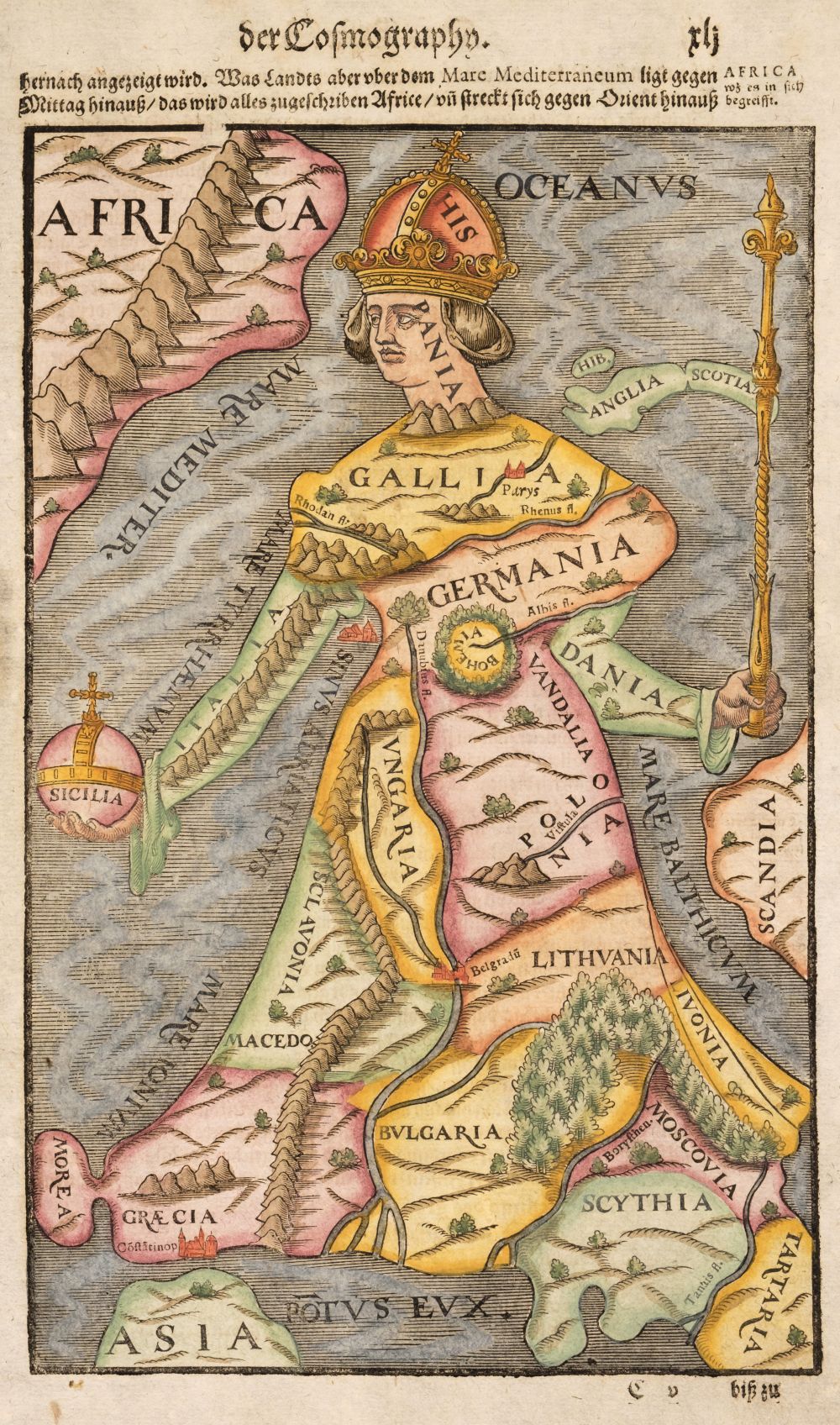
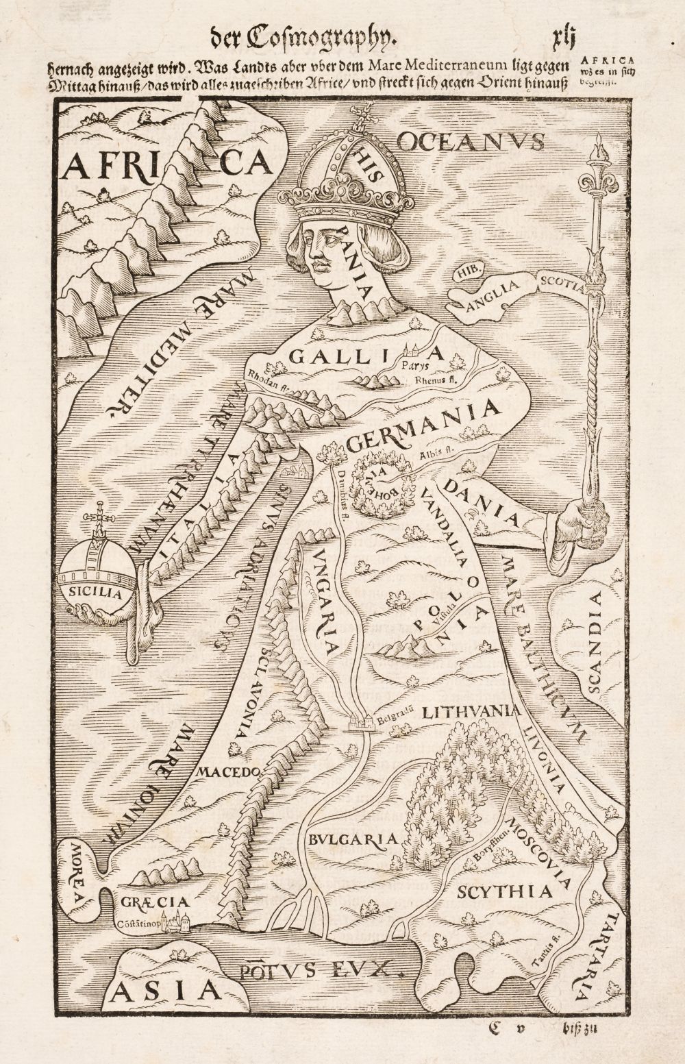
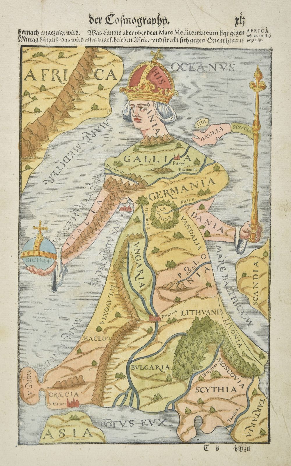
EUROPE AS A QUEEN. MÜNSTER, SEBASTIAN. Europe as a Queen, no place, no date (Basel, Henricpetrina, about 1580). Woodcut map (p. xli, verso xlii), depicting Europe as a queen, map size about 255x160, incl. margins 358x220. German text. Some paperloss in inner margin. Photo. During the late 16th century, a few map makers created these now highly prized map images, wherein countries and continents were given human or animal forms. Among the earliest examples is this map of Europa by Munster, which appeared for the first time in Munster's Cosmography 1545, but continuously expanded thereafter until the 1620s. It's unclear if the correspondence between these nations and body parts is indicative of some kind of hierarchy among European states, but here's an overview: HISPANIA (Spain) constitutes the head of Europe; GALLIA (France) is the upper chest; GERMANIA is the bosom; ITALIA is Europe's right arm, with SICILIA being the globus cruciger, the cross-bearing orb signifying wordly power throughout the Middle Ages; DANIA (Denmark) is the left arm of Europe, holding what appears to be a ceremonial sword, another classic piece of regalia; BOHEMIA (the Czech lands) is a circular area close to Europe's stomach; VNGARIA (Hungary) and SCLAVONIA (land of the southern Slavs) are the right thigh and and VANDALIA (probably a reference to the Wends, a collective name for Slavic peoples in present-day eastern Germany) and POLONIA form the left thigh of Europe; LITHVANIA must be about the spot of Europe's left knee; LIVONIA, MACEDONIA , BVLGARIA, MOSCOVIA, MOREA (the mediaeval name for the Peloponnese peninsula), GRAECIA, SCYTHIA (present-day Bulgaria), TARTARIA (parts of present-day Russia) are folds ever further down Europe's flowing dress. Hibernia, Anglia, Scotia (the English Islands) are out of the figure to the right, as well as Scandinavia.
EUROPE AS A QUEEN. MÜNSTER, SEBASTIAN. Europe as a Queen, no place, no date (Basel, Henricpetrina, about 1580). Woodcut map (p. xli, verso xlii), depicting Europe as a queen, map size about 255x160, incl. margins 358x220. German text. Some paperloss in inner margin. Photo. During the late 16th century, a few map makers created these now highly prized map images, wherein countries and continents were given human or animal forms. Among the earliest examples is this map of Europa by Munster, which appeared for the first time in Munster's Cosmography 1545, but continuously expanded thereafter until the 1620s. It's unclear if the correspondence between these nations and body parts is indicative of some kind of hierarchy among European states, but here's an overview: HISPANIA (Spain) constitutes the head of Europe; GALLIA (France) is the upper chest; GERMANIA is the bosom; ITALIA is Europe's right arm, with SICILIA being the globus cruciger, the cross-bearing orb signifying wordly power throughout the Middle Ages; DANIA (Denmark) is the left arm of Europe, holding what appears to be a ceremonial sword, another classic piece of regalia; BOHEMIA (the Czech lands) is a circular area close to Europe's stomach; VNGARIA (Hungary) and SCLAVONIA (land of the southern Slavs) are the right thigh and and VANDALIA (probably a reference to the Wends, a collective name for Slavic peoples in present-day eastern Germany) and POLONIA form the left thigh of Europe; LITHVANIA must be about the spot of Europe's left knee; LIVONIA, MACEDONIA , BVLGARIA, MOSCOVIA, MOREA (the mediaeval name for the Peloponnese peninsula), GRAECIA, SCYTHIA (present-day Bulgaria), TARTARIA (parts of present-day Russia) are folds ever further down Europe's flowing dress. Hibernia, Anglia, Scotia (the English Islands) are out of the figure to the right, as well as Scandinavia.





.jpg)
/1733/Internet%20Image%201.jpg)

Try LotSearch and its premium features for 7 days - without any costs!
Be notified automatically about new items in upcoming auctions.
Create an alert