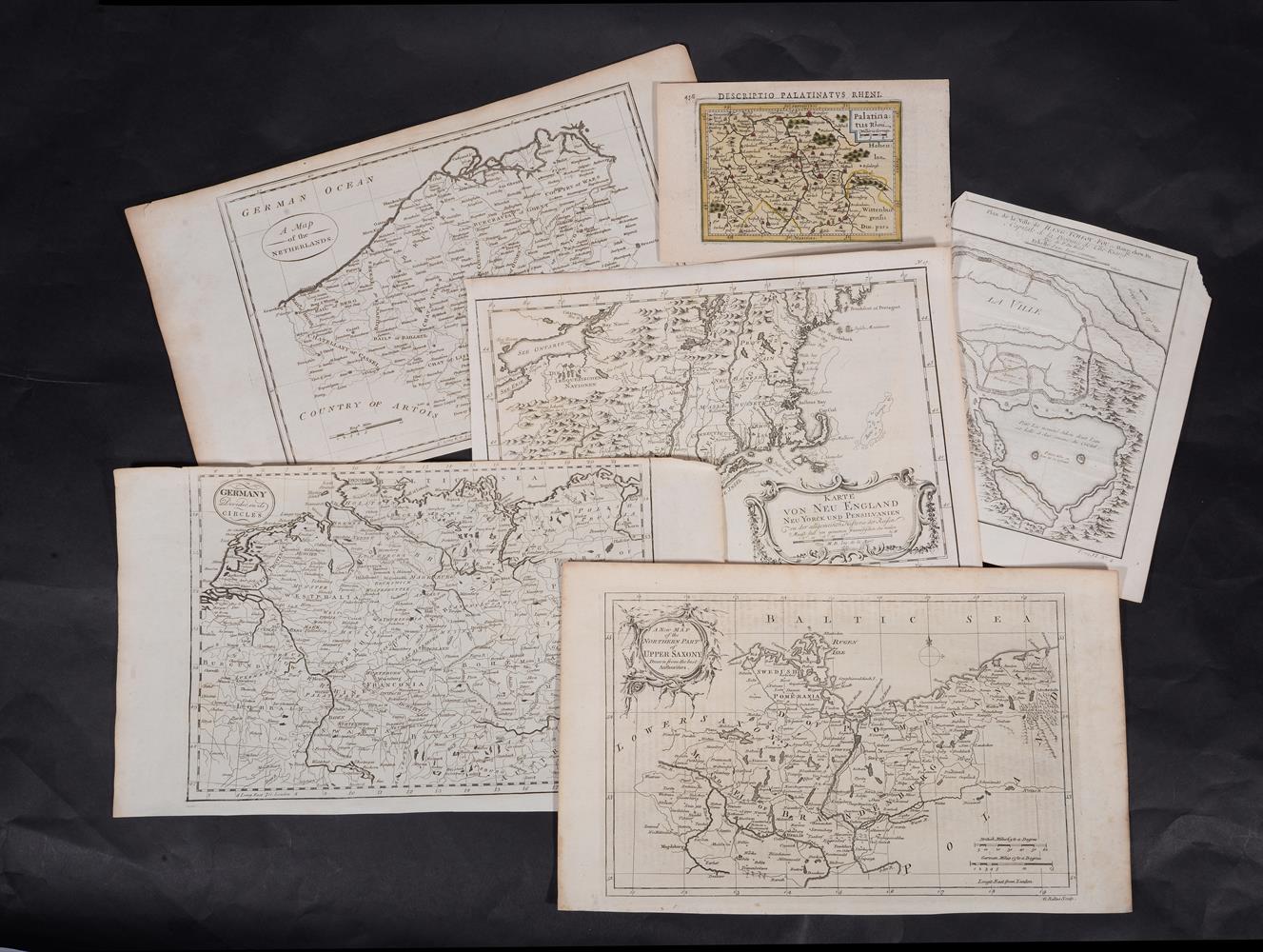
EUROPE]. A group of 29 maps of Europe and European regional maps including: L'ISLE, Guillaume de. Carte d'Europe. Paris, 1724. Engraved map, colored by a contemporary hand, image 352 x 498 mm (393 x 529 mm). -- COVENS, Johannes and Cornelis MORTIER. Theatrum Historicum pars Occidentalis. Amsterdam, n.d. Engraved map, hand-colored, image 494 x 612 mm (522 x 650 mm sheet). -- SANSON, Nicholas. Le Royaume de Hongerie Amsterdan: Mortier, ca 1699. Engraved map, hand-colored in outline, image 970 x 600 mm (1000 x 640 mm sheet). -- ORTELIUS, Abraham. Cypri Insulae nova descrpt. Amsterdam, 1573. Engraved map, hand-colored, image 500 x 616 mm (547 x 695 mm). -- [ With: ] 25 other European maps. Condition varies. (29)
EUROPE]. A group of 29 maps of Europe and European regional maps including: L'ISLE, Guillaume de. Carte d'Europe. Paris, 1724. Engraved map, colored by a contemporary hand, image 352 x 498 mm (393 x 529 mm). -- COVENS, Johannes and Cornelis MORTIER. Theatrum Historicum pars Occidentalis. Amsterdam, n.d. Engraved map, hand-colored, image 494 x 612 mm (522 x 650 mm sheet). -- SANSON, Nicholas. Le Royaume de Hongerie Amsterdan: Mortier, ca 1699. Engraved map, hand-colored in outline, image 970 x 600 mm (1000 x 640 mm sheet). -- ORTELIUS, Abraham. Cypri Insulae nova descrpt. Amsterdam, 1573. Engraved map, hand-colored, image 500 x 616 mm (547 x 695 mm). -- [ With: ] 25 other European maps. Condition varies. (29)
EUROPE]. A group of 29 maps of Europe and European regional maps including: L'ISLE, Guillaume de. Carte d'Europe. Paris, 1724. Engraved map, colored by a contemporary hand, image 352 x 498 mm (393 x 529 mm). -- COVENS, Johannes and Cornelis MORTIER. Theatrum Historicum pars Occidentalis. Amsterdam, n.d. Engraved map, hand-colored, image 494 x 612 mm (522 x 650 mm sheet). -- SANSON, Nicholas. Le Royaume de Hongerie Amsterdan: Mortier, ca 1699. Engraved map, hand-colored in outline, image 970 x 600 mm (1000 x 640 mm sheet). -- ORTELIUS, Abraham. Cypri Insulae nova descrpt. Amsterdam, 1573. Engraved map, hand-colored, image 500 x 616 mm (547 x 695 mm). -- [ With: ] 25 other European maps. Condition varies. (29)
EUROPE]. A group of 29 maps of Europe and European regional maps including: L'ISLE, Guillaume de. Carte d'Europe. Paris, 1724. Engraved map, colored by a contemporary hand, image 352 x 498 mm (393 x 529 mm). -- COVENS, Johannes and Cornelis MORTIER. Theatrum Historicum pars Occidentalis. Amsterdam, n.d. Engraved map, hand-colored, image 494 x 612 mm (522 x 650 mm sheet). -- SANSON, Nicholas. Le Royaume de Hongerie Amsterdan: Mortier, ca 1699. Engraved map, hand-colored in outline, image 970 x 600 mm (1000 x 640 mm sheet). -- ORTELIUS, Abraham. Cypri Insulae nova descrpt. Amsterdam, 1573. Engraved map, hand-colored, image 500 x 616 mm (547 x 695 mm). -- [ With: ] 25 other European maps. Condition varies. (29)









Testen Sie LotSearch und seine Premium-Features 7 Tage - ohne Kosten!
Lassen Sie sich automatisch über neue Objekte in kommenden Auktionen benachrichtigen.
Suchauftrag anlegen