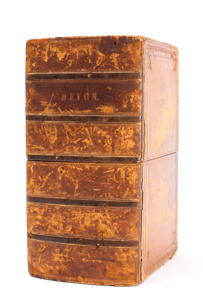
DEVON ORDNANCE SURVEY ... The Second Part of the General Survey of England and Wales containing the whole of Devon and a portion of the adjoining Counties. Done by the surveyors of His Majesty's Ordnance, under the Direction of Lt Col Mudge - Large folding map in seven sections dissecting in to 24 segments to each section and mounted on linen. in original calf book box which is well rubbed. Overall size 2450 x 1850 mm, however two of the maps have been trimmed in the sea areas reducing the size of those two maps ( sheets 24 & 27 ) although none of the printed map is missing. Sheets 20, 21, 22, 24, 25, 26. 1809. * the earliest ordnance survey of Devon.
DEVON ORDNANCE SURVEY ... The Second Part of the General Survey of England and Wales containing the whole of Devon and a portion of the adjoining Counties. Done by the surveyors of His Majesty's Ordnance, under the Direction of Lt Col Mudge - Large folding map in seven sections dissecting in to 24 segments to each section and mounted on linen. in original calf book box which is well rubbed. Overall size 2450 x 1850 mm, however two of the maps have been trimmed in the sea areas reducing the size of those two maps ( sheets 24 & 27 ) although none of the printed map is missing. Sheets 20, 21, 22, 24, 25, 26. 1809. * the earliest ordnance survey of Devon.


Try LotSearch and its premium features for 7 days - without any costs!
Be notified automatically about new items in upcoming auctions.
Create an alert