DELISLE, Joseph-Nicolas. Explication de la carte des nouvelles decouvertes au nord de la mer sud . Paris: Desaint and Saillaint, 1752.
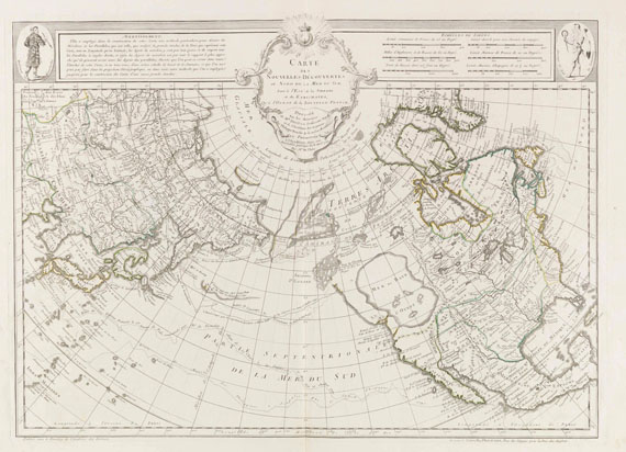
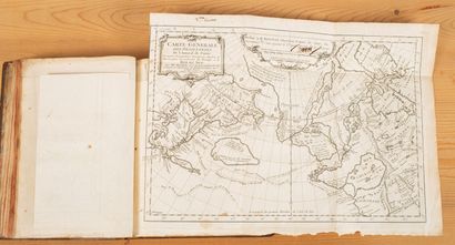
DELISLE, Joseph-Nicolas. Explication de la carte des nouvelles decouvertes au nord de la mer sud . Paris: Desaint and Saillaint, 1752. 4 o (264 x 198 mm). 18 pages. Engraved folding map "Carte des nouvelles découvertes au nord ed le la mer du sud" (465 x 652 mm) by Phillippe Buache and Joseph-Nicolas Delisle (North America and the north sea colored by hand). (Some pale marginal dampstaining to text.) Disbound. Provenance : undecipherable Russian library inkstamps on title. Engraved on a spherical projection, this map purports in its imprint to have been presented by Delisle to the Academie des Sciences, 8 April 1750, when Delisle read his memoir. It may not have been published, however, until it was issued in 1752 with the present Explication . The track of Admiral Bartholomew de Fonte is laid along the coast, omitted in the next issue of the map. Investigations of the maps claims "demonstrated that Fonte's tale [of discoveries of a possible Northwest Passage] was impossible and that Buache's map did not even correspond to it; yet many geographers accepted it, and many maps of the latter part of the eighteenth century will be found which display Fonte's alleged discoveries and the vast Sea of the West in the northern part of North America near the northwest coast. The vogue attained by the Delisle-Buache maps was principally attributable to the immense reputation enjoyed by [Joseph-Nicolas's brother] Guillaume Delisle in the eighteenth century and to the increased interest in the search for the Northwest Passage" (Wagner Northwest Coast , p.160). Wagner Northwest Coast 1750 ("THE ORIGINAL IMPRESSION IS VERY SCARCE").

.jpg)
.jpg)


Try LotSearch and its premium features for 7 days - without any costs!
Be notified automatically about new items in upcoming auctions.
Create an alert