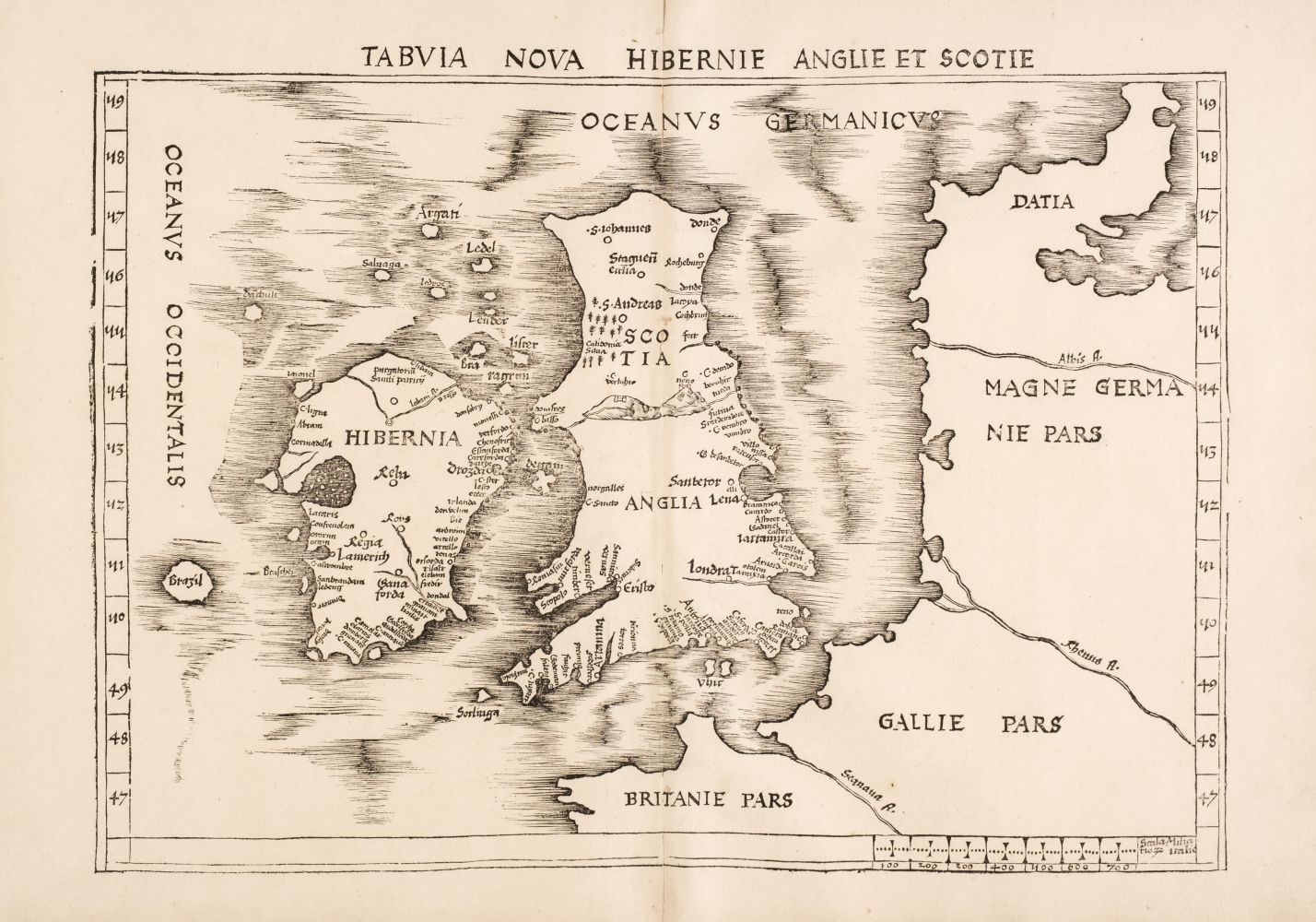
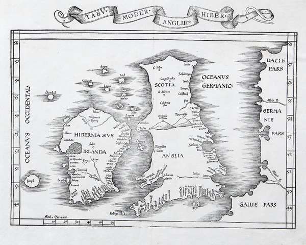
British Isles. Waldseemuller (Martin), Tabula Nova Hibernie Anglie et Scotie, Strasbourg, 1513, uncoloured woodblock map, a few small repaired wormholes to the central fold, large margins, 380 x 520 mm, mounted, framed and glazed (Qty: 1) R. W. Shirley. Early Printed Maps of the British Isles,11. A scarce early map often described as the first 'modern map of the British Isles'. Published in Ptolomey's 'Geographia' it is the first map not reliant on Ptolemaic geography; instead, it used entirely contemporary sources. It was also the first map of the British Isles to include a mileage scale with a scale of (Italian) miles to the lower right. Note the mythical island of Brazil off the west coast of Ireland.
British Isles. Waldseemuller (Martin), Tabula Nova Hibernie Anglie et Scotie, Strasbourg, 1513, uncoloured woodblock map, a few small repaired wormholes to the central fold, large margins, 380 x 520 mm, mounted, framed and glazed (Qty: 1) R. W. Shirley. Early Printed Maps of the British Isles,11. A scarce early map often described as the first 'modern map of the British Isles'. Published in Ptolomey's 'Geographia' it is the first map not reliant on Ptolemaic geography; instead, it used entirely contemporary sources. It was also the first map of the British Isles to include a mileage scale with a scale of (Italian) miles to the lower right. Note the mythical island of Brazil off the west coast of Ireland.




Testen Sie LotSearch und seine Premium-Features 7 Tage - ohne Kosten!
Lassen Sie sich automatisch über neue Objekte in kommenden Auktionen benachrichtigen.
Suchauftrag anlegen