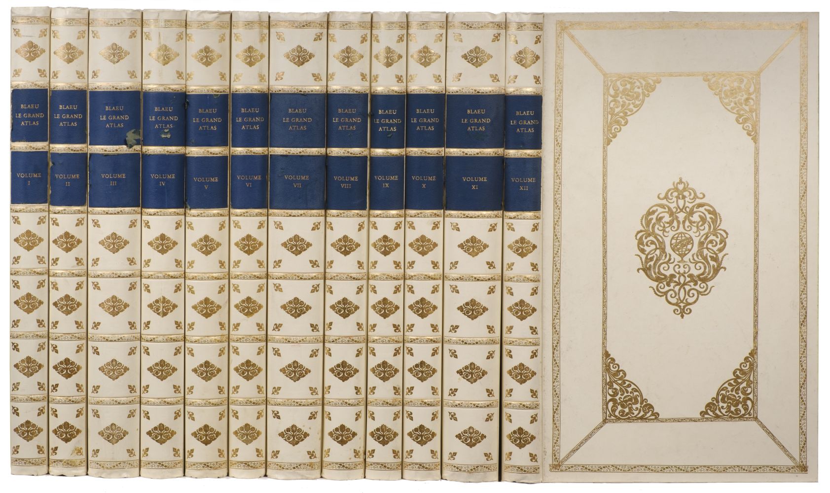
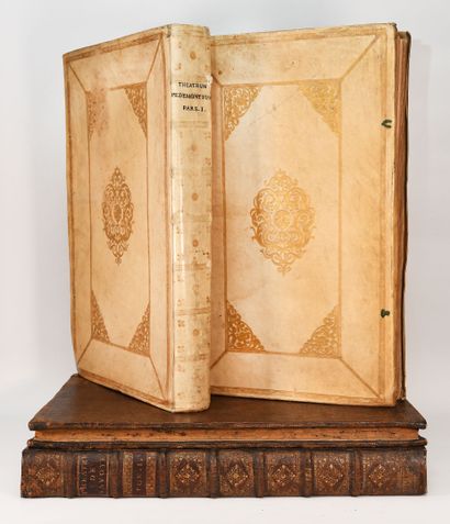
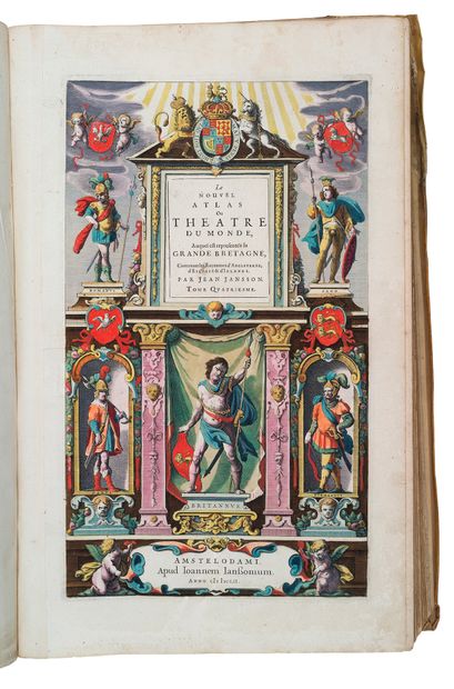
BLAEU, Johannes. [Le Grand Atlas, ou Cosmographie Blaviane, en laquelle est exactement descritte le terre, la mer, et le ciel.] Amsterdam: J.Blaeu, 1662-1667 [or later]. 10 volumes only (of 12, lacking vols.X and XII), 2° (535 x 334mm). Mounted on guards throughout. Six letterpress titles with woodcut vignettes, 8 engraved allegorical additional titles with pasted-on sections, 2 engraved section titles (one with pasted-on section), 529 ENGRAVED MAPS, PLANS AND PLATES, ALL VERY FINELY COLOURED BY A CONTEMPORARY HAND, MANY HEIGHTENED IN GOLD, (including: Tycho Brahe's plates of astronomical instruments; 515 maps, 3 folding and 492 double-page), occasional wood-cut or engraved illustrations, many hand-coloured, EXTRA-ILLUSTRATED WITH 55 ADDITIONAL DOUBLE-PAGE OR FOLDING MAPS, ALL HAND-COLOURED IN A CONTEMPORARY HAND, by N.Visscher, F.de Wit and others. (Some browning, particularly to vol.XI, tears to about 20 of the double-page maps, about six maps shaved into the plate area, three letterpress titles and four engraved titles and some preliminary text not bound in.) Publisher's vellum gilt, covers panelled, the inner panel with elaborate blocked cornerpieces surrounding a central lozenge-shaped block incorporating the Blaeu sphere device, flat-backed spines, divided into eight panels, lettered in one, green silk ties, or remains of ties, g.e. (some light soiling, particularly to the spines). A FINE UNSOPHISTICATED NEAR-COMPLETE SET, WITH BEAUTIFUL COLOURING, OF WHAT HAS BEEN CALLED 'THE GREATEST AND FINEST ATLAS EVER PUBLISHED'. The set is mixed (vols.I-II, V-IX and XI appear to be from both the first and second French editions, vols.III-IV are in Latin, probably from the first edition) and it appears to have been assembled and coloured to order in the 1690's probably from the Blaeu plate stocks of Abraham Wolfgang acquired at the Blaeu (the Visscher map of the East Indies can be dated to ca.1690 [Tooley Mapping of Australia 1300]). The additional maps appear to have been coloured by the same hand as the main body of maps and either duplicate the more important maps but show the 'latest' information, or map in detail areas not covered by the Blaeu maps. Cf. Koeman Bl 56, 58 and 59. The work comprises: Vol.I NORTHERN EUROPE, first or second edition in French: 61 maps, plates and plans (45 double-page) including 14 plates and plans of astronomical instruments. Extra-illustrated with 3 double-page maps by de Wit a world map [Shirley 451 (second state)]; Europae and Ducatus Slesvicensis . Hand-coloured engraved title and one section title. Woodcut and engraved illustrations. (Lacking printed title, general title and some preliminaries). Vol.II NORTHERN and EASTERN EUROPE and GREECE, first edition in French: 40 maps and plates (all but one double-page) including plans of Moscow and the Kremlin. Extra-illustrated with one folding and 10 double-page maps: including 4 of parts of the Ukraine, and others by de Wit Regni Poloniae; Regni Hungarie ... 1686 (folding); Regnum Hungaria; Insula Candia. N.Visscher. Archipelagi nec non Graeciae; Peloponnesus hodie Morea. Hondius. Novissima Russiae tabula. Uncoloured illustrations. Vol.III GERMANY, first edition in Latin: 95 engraved maps only (of 96, lacking Koeman's no.94)(3 folding, 92 double-page). Extra-illustrated with 11 double-page maps: Archiepiscopatus Trevirensis ; one by N.Visscher. Leodiensis Episcopatus ; and 9 by de Wit Regnum Bohemia ; Circulus Bavaricus; Circuli Saxoniae Inferioris; Holsatiae; Circulus Franconicus; Circulus Suevicus; Alsatiae. Vol.IV NETHERLANDS, first edition in Latin: 63 engraved maps (60 double-page). Extra-illustrated with 19 double-page maps by Visscher, including 17 provinces and 2 others: Provincarium Germanie Inferioris and Belgii Regii . French engraved title and section title. Vol.V ENGLAND, first or second edition in French: 58 engraved maps (57 double-page). Extra-illustrated with 1 folding map: N.Visscher's A New Mapp of the Kingdom of England .
BLAEU, Johannes. [Le Grand Atlas, ou Cosmographie Blaviane, en laquelle est exactement descritte le terre, la mer, et le ciel.] Amsterdam: J.Blaeu, 1662-1667 [or later]. 10 volumes only (of 12, lacking vols.X and XII), 2° (535 x 334mm). Mounted on guards throughout. Six letterpress titles with woodcut vignettes, 8 engraved allegorical additional titles with pasted-on sections, 2 engraved section titles (one with pasted-on section), 529 ENGRAVED MAPS, PLANS AND PLATES, ALL VERY FINELY COLOURED BY A CONTEMPORARY HAND, MANY HEIGHTENED IN GOLD, (including: Tycho Brahe's plates of astronomical instruments; 515 maps, 3 folding and 492 double-page), occasional wood-cut or engraved illustrations, many hand-coloured, EXTRA-ILLUSTRATED WITH 55 ADDITIONAL DOUBLE-PAGE OR FOLDING MAPS, ALL HAND-COLOURED IN A CONTEMPORARY HAND, by N.Visscher, F.de Wit and others. (Some browning, particularly to vol.XI, tears to about 20 of the double-page maps, about six maps shaved into the plate area, three letterpress titles and four engraved titles and some preliminary text not bound in.) Publisher's vellum gilt, covers panelled, the inner panel with elaborate blocked cornerpieces surrounding a central lozenge-shaped block incorporating the Blaeu sphere device, flat-backed spines, divided into eight panels, lettered in one, green silk ties, or remains of ties, g.e. (some light soiling, particularly to the spines). A FINE UNSOPHISTICATED NEAR-COMPLETE SET, WITH BEAUTIFUL COLOURING, OF WHAT HAS BEEN CALLED 'THE GREATEST AND FINEST ATLAS EVER PUBLISHED'. The set is mixed (vols.I-II, V-IX and XI appear to be from both the first and second French editions, vols.III-IV are in Latin, probably from the first edition) and it appears to have been assembled and coloured to order in the 1690's probably from the Blaeu plate stocks of Abraham Wolfgang acquired at the Blaeu (the Visscher map of the East Indies can be dated to ca.1690 [Tooley Mapping of Australia 1300]). The additional maps appear to have been coloured by the same hand as the main body of maps and either duplicate the more important maps but show the 'latest' information, or map in detail areas not covered by the Blaeu maps. Cf. Koeman Bl 56, 58 and 59. The work comprises: Vol.I NORTHERN EUROPE, first or second edition in French: 61 maps, plates and plans (45 double-page) including 14 plates and plans of astronomical instruments. Extra-illustrated with 3 double-page maps by de Wit a world map [Shirley 451 (second state)]; Europae and Ducatus Slesvicensis . Hand-coloured engraved title and one section title. Woodcut and engraved illustrations. (Lacking printed title, general title and some preliminaries). Vol.II NORTHERN and EASTERN EUROPE and GREECE, first edition in French: 40 maps and plates (all but one double-page) including plans of Moscow and the Kremlin. Extra-illustrated with one folding and 10 double-page maps: including 4 of parts of the Ukraine, and others by de Wit Regni Poloniae; Regni Hungarie ... 1686 (folding); Regnum Hungaria; Insula Candia. N.Visscher. Archipelagi nec non Graeciae; Peloponnesus hodie Morea. Hondius. Novissima Russiae tabula. Uncoloured illustrations. Vol.III GERMANY, first edition in Latin: 95 engraved maps only (of 96, lacking Koeman's no.94)(3 folding, 92 double-page). Extra-illustrated with 11 double-page maps: Archiepiscopatus Trevirensis ; one by N.Visscher. Leodiensis Episcopatus ; and 9 by de Wit Regnum Bohemia ; Circulus Bavaricus; Circuli Saxoniae Inferioris; Holsatiae; Circulus Franconicus; Circulus Suevicus; Alsatiae. Vol.IV NETHERLANDS, first edition in Latin: 63 engraved maps (60 double-page). Extra-illustrated with 19 double-page maps by Visscher, including 17 provinces and 2 others: Provincarium Germanie Inferioris and Belgii Regii . French engraved title and section title. Vol.V ENGLAND, first or second edition in French: 58 engraved maps (57 double-page). Extra-illustrated with 1 folding map: N.Visscher's A New Mapp of the Kingdom of England .


.jpg?height=400)


Testen Sie LotSearch und seine Premium-Features 7 Tage - ohne Kosten!
Lassen Sie sich automatisch über neue Objekte in kommenden Auktionen benachrichtigen.
Suchauftrag anlegen