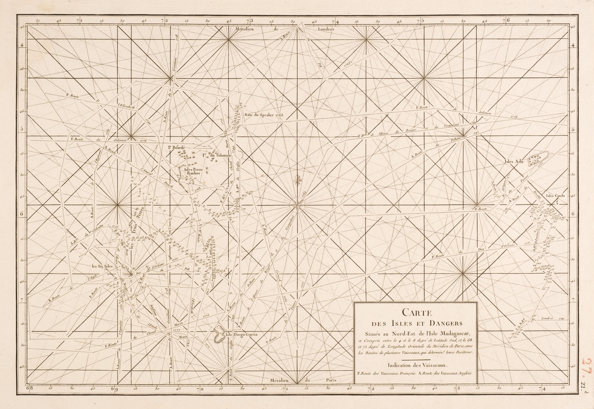
APRES DE MANNEVILLETTE, Jean-Baptiste Nicolas Denis d' (1707-1780). Le Neptune Oriental. Paris: Demonville and Brest: Malassis, 1775. A major hydrographic atlas of the 18th century . Second edition, adding 41 new charts to the 22 of the first edition of 1745. The ‘Instructions sur la navigation de la France aux Indes’, placed at the head of the atlas, form an important text. ‘The author gives directions for navigating to Brazil, and the position of Rio. It [the atlas] also contains a plan of Rio (plate 50) made by the author in 1757’ (Borba de Moraes I, 43). In navigation to the east, careful consideration is given to China routes (see pp.146-179, 191-192); plate 52 is a chart of the China Sea. Cordier I, 134 calls the atlas ‘ce superbe ouvrage’ and for Lust 162 it is ‘a vast, superb volume’. Four of the charts are by Alexander Dalrymple, a personal friend of the author’s. There appear to be variations in the make-up of the atlas and the plate list itself is unreliable. Plates 10 and 46 were clearly not issued. Plates 50 to 61 as described on the list differ from the numbering order actually used in the atlas. The plates listed as numbers 60 and 61, for example, were actually issued as plates 58 and 59. NMM calls for 63 charts as present here. A supplement issued in 1781 brought the plate count to 78. Howgego A107; NMM III(1), 204; Phillips, Atlases 3166; Shirley BL II, M.Apr-1c. Large folio (576 x 401mm). Engraved frontispiece by J.B. Tilliard after F. Boucher, dedication to Louis XIV with engraved headpiece and opening initial, 63 numbered engraved charts by Guillaume de la Haye as called for by NMM, 29 double-page (plate 16 affected by paper fault, plate 56 slightly soiled at margin, light waterstaining at margins). Contemporary marbled boards with calf spine label, uncut (restored).
APRES DE MANNEVILLETTE, Jean-Baptiste Nicolas Denis d' (1707-1780). Le Neptune Oriental. Paris: Demonville and Brest: Malassis, 1775. A major hydrographic atlas of the 18th century . Second edition, adding 41 new charts to the 22 of the first edition of 1745. The ‘Instructions sur la navigation de la France aux Indes’, placed at the head of the atlas, form an important text. ‘The author gives directions for navigating to Brazil, and the position of Rio. It [the atlas] also contains a plan of Rio (plate 50) made by the author in 1757’ (Borba de Moraes I, 43). In navigation to the east, careful consideration is given to China routes (see pp.146-179, 191-192); plate 52 is a chart of the China Sea. Cordier I, 134 calls the atlas ‘ce superbe ouvrage’ and for Lust 162 it is ‘a vast, superb volume’. Four of the charts are by Alexander Dalrymple, a personal friend of the author’s. There appear to be variations in the make-up of the atlas and the plate list itself is unreliable. Plates 10 and 46 were clearly not issued. Plates 50 to 61 as described on the list differ from the numbering order actually used in the atlas. The plates listed as numbers 60 and 61, for example, were actually issued as plates 58 and 59. NMM calls for 63 charts as present here. A supplement issued in 1781 brought the plate count to 78. Howgego A107; NMM III(1), 204; Phillips, Atlases 3166; Shirley BL II, M.Apr-1c. Large folio (576 x 401mm). Engraved frontispiece by J.B. Tilliard after F. Boucher, dedication to Louis XIV with engraved headpiece and opening initial, 63 numbered engraved charts by Guillaume de la Haye as called for by NMM, 29 double-page (plate 16 affected by paper fault, plate 56 slightly soiled at margin, light waterstaining at margins). Contemporary marbled boards with calf spine label, uncut (restored).

.jpg)


.jpg)


.jpg?w=400)


Try LotSearch and its premium features for 7 days - without any costs!
Be notified automatically about new items in upcoming auctions.
Create an alert